place

River Douglas, Lancashire

Douglas catchmentRivers of Greater ManchesterRivers of LancashireUse British English from May 2019West Pennine Moors
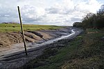
River Douglas at Appley Bridge geograph.org.uk 174858

The River Douglas, also known as the River Asland or Astland, flows through parts of Lancashire and Greater Manchester in North West England. It is a tributary of the River Ribble and has several tributaries, the major ones being the River Tawd and the River Yarrow. In 1720 an act of Parliament was passed allowing Thomas Steers and William Squire to make the Douglas navigable to small ships between Wigan and its mouth. Amid financial irregularities, the Douglas Navigation was not completed until 1742, and by 1783, it had been superseded by the Leeds and Liverpool Canal. It reverted to being a river, although the remains of several locks can still be seen between Parbold and Gathurst. The Rufford Branch of the canal joins the river at Tarleton. The river rises on Winter Hill on the West Pennine Moors, and flows for 35 miles (56 km) through several towns and onto the Ribble estuary past Tarleton, the last 10 miles (16 km) or so being tidal. In 1892 the Douglas was diverted in Wigan to allow the construction of Wigan Central railway station.

Excerpt from the Wikipedia article River Douglas, Lancashire (License: CC BY-SA 3.0, Authors, Images).

River Douglas, Lancashire
South Ribble Longton

Geographical coordinates (GPS) Address Nearby Places
placeShow on map

Wikipedia: River Douglas, LancashireContinue reading on Wikipedia

Geographical coordinates (GPS)

Latitude Longitude
N 53.7347 ° E -2.8550722222222 °
placeShow on map

Address

Longton


South Ribble, Longton
England, United Kingdom
mapOpen on Google Maps

River Douglas at Appley Bridge geograph.org.uk 174858
Share experience

Nearby Places

Newton-with-Scales
Newton-with-Scales

Newton-with-Scales is a village in the county of Lancashire and in the Borough of Fylde. It is situated on the A583 road, 5 miles (8 km) from Preston and 11 miles (18 km) from Blackpool, in the civil parish of Newton-with-Clifton. It has a park situated on School Lane, a restaurant / pub called the Bell and Bottle, a primary school called Newton Bluecoats, a shop called The convenience store which also has a Post Office. On the main road out of the village you will also find a Petrol Station and an Indian Restaurant called Ali Raj. Formerly the village was two hamlets: Scales on the main road from Preston to Kirkham, and Newton on a loop to the south. The name Newton is from Old English, meaning "new farm" or "new village"; Scales is from a word of Scandinavian origin meaning "hut".Newton was mentioned in the Domesday Book as a member of the fee of Earl Tostig. By 1212 it had become part of the barony of Penwortham. In the 16th century both Newton and Scales were referred to as manors. Newton Bluecoat school was established in 1707 by John Hornby for boys and girls up to the age of 14 years; it is now a primary school. It was rebuilt in 1864, and replaced by a new building in 1969.The township of Newton-with-Scales was part of the parish of Kirkham; by 1912 it had its own parish council and formed part of Fylde Rural District. Located east of Freckleton and west of Clifton, the township extended north from the River Ribble to boundaries with Kirkham to the north-west and Treales, Roseacre and Wharles to the north. It included the hamlet of Dowbridge on the main road near Kirkham. As of 1912 it consisted of 1,5221⁄2 acres (including around 15 acres of tidal water in the Ribble estuary). Most of the area was pasture. The southern part, crossed by the Preston to Freckleton road, is flat and includes reclaimed land close to the river; the village is to the north on a slope that rises to 50 feet. As of the 1931 census the civil parish of Newton-with-Scales had a population of 343. In 1934 it merged with Clifton-with-Salwick (1931 census population: 428) to form Newton-with-Clifton.Formerly a rural community, it has expanded with many new houses built since the 1940s. Since World War II, Springfields nuclear fuel production site and British Aerospace at Warton Aerodrome have been major employers in the area, and also by the 1980s many residents worked in Preston, Blackpool and other towns in the region.

Hesketh Bank railway station

Hesketh Bank railway station was a railway station on the West Lancashire Railway (WLR) in North West England, which served the village of Hesketh Bank. The station, originally known as 'Hesketh Bank and Tarleton', opened on 20 February 1878 and was located on the western bank of the River Douglas near a dock where the WLR operated a steamship across the River Ribble to Lytham St Annes. By 1882 the station was referred to as 'Hesketh for Tarleton', but by 1895 the station appears to have been formally renamed to just 'Hesketh Bank'.The station was originally the northern terminus of what was to be the Southport-Preston Line, running from Hesketh Park on the northern outskirts of Southport; the line through to Preston was opened in September 1888 after the opening of a swing bridge over the Douglas in May of that year. An engine shed was located at the station but closed when the station became a through station, and was demolished by the following year.In 1880 a short goods line, approximately 1.25 miles (2 km) long, was opened along the west bank of the river to a terminus at Tarleton Lock, at the end of the Rufford Branch of the Leeds and Liverpool Canal. As the WLR did not own the land upon which the line was constructed, nor was it acquired by an Act of Parliament, the company had to pay a lease fee (presumably to the local borough council) until 3 September 1881, after the land was vested by Act to the WLR on 3 June 1881.The station closed on 7 September 1964 as a result of the Beeching axe, the buildings and platforms demolished and the rails removed by February 1965, and the land later developed as a housing estate.