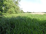
Worlington, Suffolk
Civil parishes in SuffolkForest HeathSuffolk geography stubsVillages in SuffolkWorlington, Suffolk

Worlington is a village and civil parish in the English county of Suffolk and in the old hundred of Lackford. It is recorded in the Domesday Book as Wirilintona. Worlington lies on the south bank of the River Lark on the B1102 Fordham–Mildenhall road one mile south-west of Mildenhall. The B1102 (The Street) forms the main road with Golf Links Road heading south from the centre of the village. Worlington Golf Links Halt railway station used to serve the golf club. Administratively, Worlington forms part of the district of West Suffolk.
Excerpt from the Wikipedia article Worlington, Suffolk (License: CC BY-SA 3.0, Authors, Images).Worlington, Suffolk
Lark Close, West Suffolk
Geographical coordinates (GPS) Address Nearby Places Show on map
Geographical coordinates (GPS)
| Latitude | Longitude |
|---|---|
| N 52.333 ° | E 0.486 ° |
Address
Worlington (Worlington Golf Links Halt)
Lark Close
IP28 8SA West Suffolk
England, United Kingdom
Open on Google Maps


