Wappingers Falls Historic District

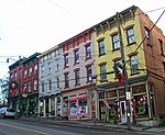
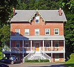
The Wappingers Falls Historic District is in the center of that village in Dutchess County, New York, United States. It is a 90-acre (36 ha) area roughly centered along South Avenue and West Main Street, NY 9D and Wappinger Creek. It includes Mesier Park in the center of the village and many adjacent residential neighborhoods, roughly bounded by Elm, Park, Walker, Market and McKinley streets. Much of the district was built in the wake of the industrialization of Wappingers Falls in the 19th century, and its styles represent a cross-section of that century. However, the contributing properties include older buildings, like the ca. 1740 Mesier-Brewer House, and newer ones like the Village Hall, formerly a post office designed under the supervision of Franklin D. Roosevelt during his presidency.
Excerpt from the Wikipedia article Wappingers Falls Historic District (License: CC BY-SA 3.0, Authors, Images).Wappingers Falls Historic District
East Main Street, Town of Wappinger
Geographical coordinates (GPS) Address Nearby Places Show on map
Geographical coordinates (GPS)
| Latitude | Longitude |
|---|---|
| N 41.598055555556 ° | E -73.918611111111 ° |
Address
East Main Street 2642
12590 Town of Wappinger
New York, United States
Open on Google Maps


