Hadstock

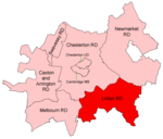
Hadstock is a village in Essex, England, about 6 miles (10 km) from Saffron Walden. It is on the county boundary with Cambridgeshire and about 9 miles (14 km) from Cambridge. The 2001 Census recorded a parish population of 320, increasing to 332 at the 2011 Census.The Church of England parish church of Saint Botolph has the oldest door still in use in Great Britain. The oldest parts of the church are thought to date from about AD 1020. Since that time the church has received many additions and undergone several renovations. On the outskirts of the village is a disused airfield that was used in World War II. While the official name for the airfield became RAF Little Walden, it was originally named after the village of Hadstock. Hadstock has a silver band.
Excerpt from the Wikipedia article Hadstock (License: CC BY-SA 3.0, Authors, Images).Hadstock
Walden Road, Uttlesford Hadstock
Geographical coordinates (GPS) Address Nearby Places Show on map
Geographical coordinates (GPS)
| Latitude | Longitude |
|---|---|
| N 52.08 ° | E 0.272 ° |
Address
Walden Road
Walden Road
CB21 4NX Uttlesford, Hadstock
England, United Kingdom
Open on Google Maps


