place

Loch Chon

Forth basinFreshwater lochs of ScotlandLochs of Stirling (council area)Source attribution
Loch Chon geograph.org.uk 1355394

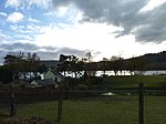
Loch Chon is a freshwater loch situated west of the village of Aberfoyle, near the small village of Kinlochard, Stirling, Scotland, UK. Loch Chon lies upstream of Loch Ard and to the south of Loch Katrine. In the past, Loch Chon was known as Loch-a-Choin - loch of the dog/dogs. Choin is the Scots Gaelic word for dog in its genitive case (coin), lenited because loch is a masculine noun, causing an 'h' to be placed after the 'c'.It releases its water into the 4.5-kilometre (2.8 mi) long Water of Chon, which not far from the outlet passes Loch Dhu, and is the main affluent of Loch Ard. Loch Chon itself is fed by several small streams which can be considered to be the true sources of the River Forth.There are three islands in the loch. Two are unnamed, including the largest, which is roughly 315 feet/96 metres long. The medium sized island is called Heron Island and is roughly 230 feet/70 metres long.

Excerpt from the Wikipedia article Loch Chon (License: CC BY-SA 3.0, Authors, Images).

Loch Chon
Lochard Road,

Geographical coordinates (GPS) Address Nearby Places
placeShow on map

Wikipedia: Loch ChonContinue reading on Wikipedia

Geographical coordinates (GPS)

Latitude Longitude
N 56.2145 ° E -4.548 °
placeShow on map

Address

Lochard Road

Lochard Road
FK8 3TP
Scotland, United Kingdom
mapOpen on Google Maps

Loch Chon geograph.org.uk 1355394
Share experience

Nearby Places

Ben Venue
Ben Venue

Ben Venue (Scottish Gaelic: A' Bheinn Mheanbh) is a mountain in the Trossachs area of Scotland. The name Ben Venue is derived from the Scottish Gaelic words meaning "the miniature mountain". The summit lies approximately 2 kilometres south-west of the pier at the southern end of Loch Katrine. At the foot of the mountain close to the shore of Loch Katrine is Bealach nam Bò meaning the "pass of the cattle", a reference to the lawless days when Highland cattle "lifters" used the pass to drive stolen herds to their land. Ben Venue is a popular walk and can be accessed from either Ledard farm track at Loch Ard, via the Beinn an Fhogharaidh ridge, or from the car park at the head of Loch Achray: both routes are approximately 5 km in length. A sign in the forestry warns that the mountain should not be approached or descended directly to or from Loch Katrine, as the slopes on this side are very steep and littered with dangerous cliffs. Several indistinct paths do exist on this side of the hill however. Ben Venue has two summits a short distance apart. The triangulation pillar on the eastern summit has a height of 727 m above sea level, and this height is often given as the height of Ben Venue as a whole. However the western summit is shown to be slightly higher, 729 m, on the Ordnance Survey's 1:25000 map. From (either) summit on a clear day the view extend to the Firth of Forth, the Clyde and Isle of Arran and the Paps of Jura. Good views can be seen along Loch Katrine, Ben A'an, Ben More, Stob Binnein, Ben Lomond and the Arrochar Alps.