place

South Croydon railway station

DfT Category D stationsFormer London, Brighton and South Coast Railway stationsLondon stations without latest usage statistics 1415London stations without latest usage statistics 1516Rail transport stations in London fare zone 5
Railway stations in Great Britain opened in 1865Railway stations in the London Borough of CroydonRailway stations served by SouthernUse British English from August 2012
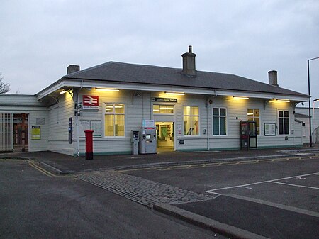
South Croydon stn building

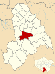
South Croydon railway station is in the London Borough of Croydon in south London, in Travelcard Zone 5. It is on the Brighton Line at its junction with the Oxted Line, 11 miles 21 chains (18.1 km) measured from London Bridge.The station is managed by Southern, and the station is served by both Southern and Thameslink services.

Excerpt from the Wikipedia article South Croydon railway station (License: CC BY-SA 3.0, Authors, Images).

South Croydon railway station
Blunt Road, London

Geographical coordinates (GPS) Address Nearby Places
placeShow on map

Wikipedia: South Croydon railway stationContinue reading on Wikipedia

Geographical coordinates (GPS)

Latitude Longitude
N 51.362888888889 ° E -0.093666666666667 °
placeShow on map

Address

Blunt Road
CR2 7FB London (London Borough of Croydon)
England, United Kingdom
mapOpen on Google Maps

South Croydon stn building
Share experience

Nearby Places

Park Hill Recreation Ground

Park Hill Recreation Ground is a 15 acres (6.1 ha) park near the centre of Croydon, Greater London, managed by the London Borough of Croydon. It runs from Barclay Road to Coombe Road beside the railway line, with the main entrances on Water Tower Hill and Barclay Road. The nearest stations (equidistant to the park) are East Croydon to the north for Tramlink and National Rail services and South Croydon to the south for National Rail. The park was officially renamed as Park Hill in 1964.At the southern end, at the very top of the hill which forms the park, it joins the grounds of Coombe Cliff once the home of members of the Horniman Tea family. From there a steep drive winds down to Coombe Road where a footpath leads to South Croydon railway station for National Rail. The grounds now form part of the park and are open to the public, but the house itself, is not. As of October 2018, it is used for educational purposes. Where the drive meets Coombe Road there is a further entrance and a gatehouse, which is now privately owned for residential purposes. The house is grade II listed.Previously the site of a reservoir, the land became a public park in the 1880s. The park contains standard amenities, including refreshments and sports facilities, as well as a walled herb garden.In his memoirs, the Chronicles of Wasted Time (1973), Malcolm Muggeridge recalls the park as a childhood playground where he and his father often walked together and discussed socialism and world affairs.