place

Hither Green railway station

Buildings containing meridian linesDfT Category C2 stationsFormer South Eastern Railway (UK) stationsLondon stations without latest usage statistics 1415London stations without latest usage statistics 1516
Rail transport stations in London fare zone 3Railway stations in Great Britain opened in 1895Railway stations in the London Borough of LewishamRailway stations served by SoutheasternUse British English from August 2012
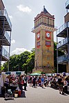
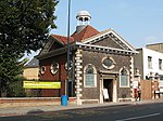
Hither Green station geograph 3678936 by Ben Brooksbank

Hither Green is a railway station located in Hither Green in the London Borough of Lewisham, south-east London. It is 7 miles 16 chains (11.6 km) down the line from London Charing Cross and is situated between Lewisham and either Grove Park or Lee depending on the route. It is a busy commuter station with services to several London termini (Cannon Street, Charing Cross and London Bridge) and destinations to other parts of south-east London and the south-east of England (Orpington and Sevenoaks on the South Eastern Main Line, and Dartford and Gravesend on the Dartford Loop Line). It is in Travelcard Zone 3 and very close to Hither Green Traction Maintenance Depot (TMD), Grove Park Traction and Rolling Stock Maintenance Depot, and Grove Park Safety Training Centre. The station straddles the Prime Meridian, which is marked across the roof of the pedestrian tunnel forming the main entrance. The station and all trains are operated by Southeastern.

Excerpt from the Wikipedia article Hither Green railway station (License: CC BY-SA 3.0, Authors, Images).

Hither Green railway station
Springbank Road, London Hither Green (London Borough of Lewisham)

Geographical coordinates (GPS) Address External links Nearby Places
placeShow on map

Wikipedia: Hither Green railway stationContinue reading on Wikipedia

Geographical coordinates (GPS)

Latitude Longitude
N 51.4519 ° E -0.0008 °
placeShow on map

Address

Hither Green

Springbank Road
SE13 6SN London, Hither Green (London Borough of Lewisham)
England, United Kingdom
mapOpen on Google Maps

linkWikiData (Q2182758)
linkOpenStreetMap (5872906105)

Hither Green station geograph 3678936 by Ben Brooksbank
Share experience

Nearby Places

River Quaggy
River Quaggy

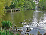
The River Quaggy (often the Quaggy River or simply Quaggy) is a river, 17 kilometres (11 mi) in length, passing through the south-east London boroughs of Bromley, Greenwich and Lewisham. In its lower reaches it is an urban river, in its upper reaches further from London it is more natural and known as the Kyd Brook. The river rises from two sources near Princess Royal University Hospital (PRUH) at Locksbottom and is a tributary of the River Ravensbourne which it flows into near Lewisham station in Lewisham.A long stretch of Kyd Brook is visible in Hawkwood, an area of open farmland and countryside upstream of Chislehurst that is owned and managed by the National Trust, but open to the public free of charge. From there the river flows northwards through Sundridge Park Golf Course then on across Chinbrook Meadows between Chinbrook and Grove Park, then through the outer parts of Mottingham, Middle Park, Horn Park, and Eltham. The river then enters Sutcliffe Park and starts to flow west through southern Kidbrooke, and Blackheath then finally through Lee and its park Manor House Gardens into Hither Green then Lewisham where it joins the River Ravensbourne next to Lewisham station. In Sutcliffe Park, the river used to run under the road and via a covered culvert through the park. This was remodelled several years ago to reintroduce a flood area to protect areas further down stream. Also this created a marshy area for wildlife to return. It is now an oasis full of wildlife in the middle of two major roads. As part of the Ravensbourne catchment area, the river is kept constantly under inspection by the Environment Agency which issues flood warnings when applicable.