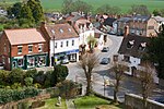
Oxhill, Warwickshire
Civil parishes in WarwickshireStratford-on-Avon DistrictUse British English from December 2020Villages in WarwickshireWarwickshire geography stubs

Oxhill is a village in South Warwickshire, England, off the A422 road between Stratford-upon-Avon and Banbury. The population taken at the 2021census was 387. It lies in the administrative district of Stratford-on-Avon in the area known as the Vale of the Red Horse. The village is mentioned in the Domesday Book as "Octeselve" and has a 12th-century church dedicated to Saint Lawrence. The indentions in the chancel window mullions are believed by many to be the marks made by local archers sharpening their arrowheads. Because of the holiness and sacredness of the church, the blessed arrows were also presumed to have divine accuracy.
Excerpt from the Wikipedia article Oxhill, Warwickshire (License: CC BY-SA 3.0, Authors, Images).Oxhill, Warwickshire
Stratford-on-Avon
Geographical coordinates (GPS) Address Nearby Places Show on map
Geographical coordinates (GPS)
| Latitude | Longitude |
|---|---|
| N 52.11053 ° | E -1.53999 ° |
Address
CV35 0QR Stratford-on-Avon
England, United Kingdom
Open on Google Maps


