Highway 71 (Israel)
All pages needing cleanupInfobox road instances in IsraelInfobox road maps tracking categoryRoads in Israel
Highway 71 is an east-west highway that passes through the eastern Jezreel Valley and the Beit She'an Valley, below the north slopes of the Gilboa mountains, in northern Israel. The road follows a path parallel to the Harod Creek in the Harod Valley and to the Jezreel Valley railway. It is 35 kilometres (22 mi) long, and leads from Afula in the west, via Beit She'an, to the Jordan River Border Crossing in the east. The Navot interchange located approximately 10 km southeast of Afula provides a shortcut via Route 675 through the Ta'anakh region from Highway 71 and Beit She'an to Highway 65 and central Israel.
Excerpt from the Wikipedia article Highway 71 (Israel) (License: CC BY-SA 3.0, Authors).Highway 71 (Israel)
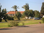
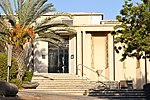
71, Gilboa Regional Council Ein Harod Meuhad
Geographical coordinates (GPS) Address Nearby Places Show on map
Geographical coordinates (GPS)
| Latitude | Longitude |
|---|---|
| N 32.558333333333 ° | E 35.370833333333 ° |
Address
71
Gilboa Regional Council, Ein Harod Meuhad
North District, Israel
Open on Google Maps


