place

The Martin High School, Anstey

1957 establishments in EnglandAcademies in LeicestershireBorough of CharnwoodEast Midlands school stubsEducational institutions established in 1957
Secondary schools in LeicestershireUse British English from February 2023

The Martin High School is a coeducational secondary school with academy status, located in the village of Anstey, Leicestershire, on the outskirts of Leicester. The school accepts students from nearby Beaumont Leys, Glenfield, Thurcaston and Cropston as well as some students from New Parks and Braunstone. The school has won awards such as The Healthy Schools Award and in its most recent Ofsted inspection the school was graded "Good".

Excerpt from the Wikipedia article The Martin High School, Anstey (License: CC BY-SA 3.0, Authors).

The Martin High School, Anstey
Link Road, Charnwood Anstey

Geographical coordinates (GPS) Address Nearby Places
placeShow on map

Wikipedia: The Martin High School, AnsteyContinue reading on Wikipedia

Geographical coordinates (GPS)

Latitude Longitude
N 52.678 ° E -1.191 °
placeShow on map

Address

Link Road

Link Road
LE7 7BX Charnwood, Anstey
England, United Kingdom
mapOpen on Google Maps

Share experience

Nearby Places

Cropston Reservoir
Cropston Reservoir

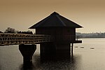
Cropston Reservoir (originally known as Bradgate Reservoir) lies in Charnwood Forest in Leicestershire, England. The dam and associated water works are in Cropston, while the bulk of the reservoir is in the neighbouring Newtown Linford parish. It was opened in May 1871 in a corner of Bradgate Park, a large expanse of open land northwest of Leicester. It is part of the 987-acre (399.3 ha) Bradgate Park and Cropston Reservoir Site of Special Scientific Interest.London-based consulting engineer Thomas Hawksley was appointed by Leicester Water Works in 1865 to carry out the surveying work. In September 1867, 180 acres (73 ha) of land adjacent to the deer park at Bradgate Park was purchased from the Earl of Stamford for a cost of £24,000. A stone wall was built by George Rudkin around the boundary to separate the deer park from the reservoir, at a cost of 8s 10d per yard. The dam is 760 yards (690 m) long and rises to a height of 51 feet (16 m) at its highest point, which gives a depth of water of 38 feet (12 m). The cost of the dam was £41,356 and the reservoir £8,500 with the contract being awarded to Benton & Woodiwiss of Derby. The reservoir was completed in 1870. The dam was originally constructed from a mixture of siliceous sand and clay, but as water was found to be leaking through it, it was rebuilt and now extends 40 feet (12 m) below the surface. Water from the reservoir was piped to four large filter beds. It was then pumped to an elevation matching the supply from Thornton Reservoir so that the supplies from the two reservoirs could be merged.The reservoir is formed by the River Lin and is owned and managed by Severn Trent. The growing population of Leicester and surrounding areas meant that by the late 19th century the reservoirs in Leicestershire were no longer adequate to meet demand, and water is now piped from Ladybower Reservoir to Cropston.

Bradgate House, Bradgate Park

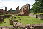
Bradgate House is a 16th-century ruin in Bradgate Park, Leicestershire, England. Edward Grey's son Sir John Grey of Groby married Elizabeth Woodville, who, after John's death married King Edward IV. Their son Thomas Grey, 1st Marquess of Dorset made preparations for building the first Bradgate House in the late 15th century but died before work began. It was his son, Thomas Grey, 2nd Marquess of Dorset who built the first Bradgate House, completing it circa 1520. This is one of the first unfortified great houses in England and one of the earliest post-Roman use of bricks. It was lived in by the Grey family for the next 220 years. It is believed that the house was the birthplace of Lady Jane Grey, later Queen, ruling for a mere 9 days before being overthrown by Mary I. After Jane and her father, Henry Grey, 1st Duke of Suffolk, were executed in 1554, the estate passed to the crown. Local history claims that groundskeepers marked the occasion of Jane's execution by pollarding the estate's oak trees in a symbolic beheading. Examples of pollarded oaks can still be seen in the park. In 1563 the family regained favour, and the Groby manor, including Bradgate, was restored to Jane's Uncle, Lord John Grey of Pirgo. His great-grandson was made Earl of Stamford. Later earls acquired estates in Enville, Staffordshire, and Dunham Massey, Cheshire. Sometime after 1739 they moved out of Bradgate, which began a long decline. The spectacular ruins of the house are still visible at the centre of the park. The house was approximately 200 feet (61 m) long, featuring a main hall measuring 80 by 30 feet (24.4 m × 9.1 m). As well as considerable remains of walls and fireplaces, it has four truncated towers and the chapel is still intact, containing a tomb effigy to Henry Grey, 1st Earl of Stamford and his wife.In the mid-19th century, George Harry Grey and the 7th Earl of Stamford and Warrington commissioned a new house to be built designed by the architect Mr M.J. Dain of Dain and Parsons, London, and built by the local builder Mr Thomas Rudkin. The new Bradgate House was completed in 1856 near the village of Groby, Leicestershire and built in the Jacobean style it has been referred to as the Calendar House because it had 365 windows, 52 rooms, and 12 main chimneys. The new house was sadly demolished in the mid-1920s when Leicestershire estates were sold by late Earl's niece Katherine Henrietta Venezia Grey, who incidentally changed her surname to Grey on the condition of her inheritance of the estates from her deceased uncle. The new Bradgate House near the village of Groby is frequently confused with the 16th-century ruined house of the same name in Bradgate Park 2 miles in distance.

Leicestershire
Leicestershire

Leicestershire ( LEST-ər-sheer, -⁠shər) is a ceremonial county in the East Midlands of England. It is bordered by Derbyshire, Nottinghamshire, and Lincolnshire to the north, Rutland to the east, Northamptonshire to the south-east, Warwickshire to the south-west, and Staffordshire to the west. The city of Leicester is the largest settlement and the county town. The county has an area of 2,156 km2 (832 sq mi) and a population of 712,300. Leicester occupies the centre of the county and is by far the largest settlement, with a built-up area population of 357,000. The remainder of the county is largely rural, and the next-largest settlements are Loughborough (65,000), Hinckley (50,000), and Coalville (22,000). For local government purposes Leicestershire comprises a non-metropolitan county with seven districts, and the unitary authority area of Leicester. Leicestershire is generally a lowland county, characterised by small, rolling hills. It is bisected by the River Soar, which rises near the Warwickshire border south of Hinckley and flows north through Leicester and Loughborough before reaching the Trent at the county boundary. To the west of the river is Charnwood Forest, an upland area which contains Bardon Hill, which at 278 m (912 ft) is the county's highest point. There are Prehistoric earthworks in the county, and Leicester was a Roman settlement. The region was settled by the Angles in the sixth century and became part of the Kingdom of Mercia, and the county existed at the time of the Domesday Survey in the 1080s. The county has had a relatively settled existence, however it was the site of the Battle of Bosworth Field in 1485, in which established the Tudor dynasty's position as monarchs of England. During the Industrial Revolution the Leicestershire coalfield in the north and west of the county was exploited. Leicester became known for shoemaking, and with Loughborough continues to be a manufacturing centre. In agriculture the county is known for Stilton cheese and Melton Mowbray pork pies.