place

Bay Circuit Trail

Appalachian Mountain ClubBay Circuit TrailHiking trails in MassachusettsLong-distance trails in the United StatesRail trails in Massachusetts
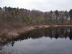
Bay Circuit Trail at Monument Street, Concord MA

The Bay Circuit Trail and Greenway or Bay Circuit is a Massachusetts rail trail and greenway connecting the outlying suburbs of Boston from Plum Island in Newburyport to Kingston Bay in Duxbury, a distance of 200 miles (320 km).Landmarks include Henry David Thoreau's Walden Pond, Great Meadows National Wildlife Refuge, the Charles River, Massachusetts Audubon's Moose Hill Wildlife Sanctuary, Minute Man National Historical Park, Lowell National Historic Park, the Merrimack River, and Plum Island. The Bay Circuit Trail connects to other long distance recreation trails, such as the Warner Trail. The Minuteman Bikeway provides a connection to downtown Boston with the Somerville Community Path. The East Coast Greenway will also connect downtown if it is completed as envisioned. The Bay Circuit is open to hiking, trail running and picnicking, and in the winter, snowshoeing. Certain parts of the trail are suitable for bicycling, horseback riding and cross country skiing. Swimming, mountain biking, hunting, fishing, and car top boating are also permitted in some properties the trail passes through. The Bay Circuit Trail is overseen by the Bay Circuit Alliance, a coalition of state, town, and federal agencies, non-profit organizations, and individuals. The Bay Circuit Alliance is led by the Appalachian Mountain Club which is working to implement the vision of the Bay Circuit by closing the final gaps of the trail, recruiting and organizing volunteers, improving the trail experience through improved maintenance and signage, securing permanent protection for the trail corridor and the greenway, and encouraging the public to get out and explore the trail’s 230+ miles.

Excerpt from the Wikipedia article Bay Circuit Trail (License: CC BY-SA 3.0, Authors, Images).

Bay Circuit Trail
BCT,

Geographical coordinates (GPS) Address Nearby Places
placeShow on map

Wikipedia: Bay Circuit TrailContinue reading on Wikipedia

Geographical coordinates (GPS)

Latitude Longitude
N 42.627841666667 ° E -71.068422222222 °
placeShow on map

Address

BCT

BCT

Massachusetts, United States
mapOpen on Google Maps

Bay Circuit Trail at Monument Street, Concord MA
Share experience

Nearby Places

Holt Farm (Andover, Massachusetts)

Holt Farm is a historic farm built in 1714 by Nicholas Holt's (1) grandson Timothy Holt (3) and located at 89 Prospect Road in Andover, Massachusetts. The house was built on the highest point in Essex County on land granted in Nicholas Holt (1). In Colonial times the Hill was referred to as Holt Hill but was changed in the late 19th century to Prospect Hill, but reverted to its original name in the early 20th century..6ed.The first Holt in Andover was Nicholas Holt (1), an early officer of the town, who was a tanner who also ran the ferry across the Shawsheen River. Nicholas Holt's (1) grandson Timothy Holt (3) built his house on the land granted to his father James Holt (2) who was granted the original 100 acres from his father, Nicholas (1). Despite some evidence that Nicholas himself was barely literate, his descendants became known for their academic accomplishments with a long line of ministers and teachers.Early settlers of Andover, some the Holts, who settled on the "Stoney Plaine", west of Holt Hill, lived near Scotsman Robert Russell (1) 1630–1710., in the part of Andover long known as the 'Scotland District. Holt Hill and its environs are actually in the Holt District, and named for the local school houses in each neighborhood. Russell, the first person to be interred in the newly designated South Parish burying ground in 1710, had ten children, three of whom married Holts from nearby Holt Farm.Much of the original Holt Farm now forms portions of the Ward Reservation and is owned by The Trustees of Reservations as a public park.

Towne Farm
Towne Farm

Towne Farm is a historic farm complex in Boxford, Massachusetts. It is the most complete remaining farm complex in the town, and is also notable for its long association with the locally prominent Towne family, which owned the surviving farmland and surrounding land from 1777 until the 1930s. The 16.9-acre (6.8 ha) was listed on the National Register of Historic Places in 2012.John Towne first came to Boxford, then a rural agricultural town, in 1777, buying half of a parcel of land belonging to his brother-in-law. He lived in the c. 1756 house on the property until 1790, when his son built the current farmhouse; the old house was demolished. Towne died in 1830, at which time his property passed to his son Samuel. Samuel sold the farmstead and 75 acres (30 ha) to his son Henry in 1845. These three generations of Townes appear to have been subsistence farmers, although Henry appears to have supplemented his income by engaging in the manufacture of shoes.Henry Towne sold the property (now 95 acres (38 ha)) to his son Hiram, who was principally in the lumbering business, but continued to maintain the farm. It is during his ownership that a number of the surviving outbuildings were built: a windmill and water tower were built in the first decade of the 20th century, but a henhouse, cottage, and camp house have not survived. He also made some modifications to the farmhouse, adding bay windows and a single story porch to its front.Hiram Towne died childless in 1932, and the farm was transferred out of the family two years later. Much of the Towne's land was given to the state, and forms part of Boxford State Forest. The farm portion went through a succession of owners in the 20th century, during which time additional neighboring parcels were sometimes added to the property. One large tract (89 acres (36 ha)) was sold in 2001 to a conservation organization, and others have been subdivided for residential development. In 2009 the farm complex and about 17 acres (6.9 ha) of land were acquired by i-Farm LLC, which has been working to restore the farm to working order.