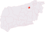
Mannings Heath

Mannings Heath is a village in the civil parish of Nuthurst and the Horsham District of West Sussex, England. The village is on the A281 road, 2 miles (3 km) south-east from the town of Horsham. Mannings Heath is the largest settlement in Nuthurst, and largely a dormitory for Horsham. Mannings Heath has an Anglican church dedicated to The Good Shepherd, built in 1881, a village hall, a village green incorporating Nuthurst Cricket Club's cricket ground, a riding school, and a golf course – Mannings Heath Golf Club, which is in both Nuthurst and the neighbouring parish of Lower Beeding. The village, previously a hamlet set around two roads, with 20 houses in 1794 and 40 in 1841, experienced a period of council and private house expansion and infill after 1945. A History of the County of Sussex commented in 1987 that roads and houses had been "built with a variety of design that largely preserved the original character of the hamlet". The West Sussex Gazette reported that 350-400 houses had been built by 1979. Two buildings, possibly 17th century, and a small number dating to 18th century remain. The village pub, the Dun Horse Inn, closed several years ago.
Excerpt from the Wikipedia article Mannings Heath (License: CC BY-SA 3.0, Authors, Images).Mannings Heath
Pound Lane,
Geographical coordinates (GPS) Address Nearby Places Show on map
Geographical coordinates (GPS)
| Latitude | Longitude |
|---|---|
| N 51.04504 ° | E -0.28317 ° |
Address
Pound Lane 1
RH13 6JJ
England, United Kingdom
Open on Google Maps


