place

Laguna Lake (California)

All accuracy disputesLakes of CaliforniaLakes of Marin County, CaliforniaLakes of Northern CaliforniaLakes of Sonoma County, California
Lakes of the San Francisco Bay AreaSonoma County, California geography stubs
LagunaLake3169
LagunaLake3169

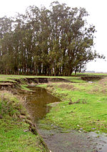
Laguna Lake is a shallow natural lake at the head of the Chileno Valley. It retains some water year round. The 200 acres (81 ha) lake is 0.5 miles (1 km) wide and 2 miles (3 km) long, straddling the Sonoma-Marin county line in northern California, United States. It is the source of Chileno Creek which flows 10 kilometres (6.2 mi) west to Walker Creek.It was included in the Rancho Laguna de San Antonio Mexican land grant, which was given to Bartolomé Bojorquez in 1845.Laguna Lake is used extensively for migrating and breeding waterfowl and Agriculture. agr.

Excerpt from the Wikipedia article Laguna Lake (California) (License: CC BY-SA 3.0, Authors, Images).

Laguna Lake (California)

Geographical coordinates (GPS) Address Nearby Places
placeShow on map

Wikipedia: Laguna Lake (California)Continue reading on Wikipedia

Geographical coordinates (GPS)

Latitude Longitude
N 38.214363 ° E -122.747767 °
placeShow on map

Address

Sonoma County (Sonoma)


California, United States
mapOpen on Google Maps

LagunaLake3169
LagunaLake3169
Share experience

Nearby Places

Training Center Petaluma

Training Center Petaluma is a Coast Guard training facility in the northern California counties of Sonoma and Marin. Formerly the installation was the United States Army "Two Rock Station" . Approximately 4,000 military students train there each year. It is the only Coast Guard training center or large installation without a major operational component (air station, motor life boat station, etc) or waterfront. The training center is located in a rural area north of San Francisco at 38.25°N 122.79°W / 38.25; -122.79. It is about 9 mi (14 km) from the coast and 9 mi (14 km) west of the city of Petaluma, California, west of the junction of Tomales Road and Valley Ford Road, just south of Stemple Creek and the village of Two Rock, California. The facility occupies more than 800 acres (320 ha) of land, which include 129 family housing units and 90 other buildings. A small town, the training center also has a movie theater, RV and camping spots, over 10 miles of hiking and walking trails, barbershop and hair salon, tailor, chapel with regular services, bowling alley, and other amenities. Public safety is provided by a Coast Guard Fire Department and a mix of Coast Guard Military Police and contracted private security, though emergency medical services including advanced life support and ambulance transport is provided by local civilian agencies. An on-installation medical clinic provides non-emergency general outpatient healthcare for active duty and reserve service members, while dependents and retirees are seen on the local civilian network.