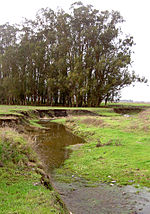
Petaluma Gap
The Petaluma Gap is a geographical region in Sonoma County, California which extends in a band from the Pacific Ocean to San Pablo Bay. It is an area of low land 22 to 31 miles (35 to 50 kilometers) wide in the coast ranges of the northern San Francisco Bay Area. The western edge of the gap is located in the coastal lowlands between Bodega Bay and Tomales Bay. The eastern edge of the gap is located at San Pablo Bay around the mouth of the Petaluma River. The city of Petaluma is near the center of the gap. The Petaluma Gap affects wind patterns (and thus microclimates and air quality) in the San Francisco Bay Area. Fresh marine air generally blows eastward through the gap, branching into southward and northward streams which blow toward the Carquinez Strait and Santa Rosa respectively. The southward stream brings marine air overland into the central Bay Area from the northwest. Warm air rises from the land and allows cold, moist air, plus winds and fog to move into the area.
Excerpt from the Wikipedia article Petaluma Gap (License: CC BY-SA 3.0, Authors).Petaluma Gap
Bodega Avenue,
Geographical coordinates (GPS) Address Nearby Places Show on map
Geographical coordinates (GPS)
| Latitude | Longitude |
|---|---|
| N 38.25055 ° | E -122.69969 ° |
Address
Bodega Avenue
Bodega Avenue
94999
California, United States
Open on Google Maps


