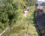
Petaluma Gap AVA
Petaluma Gap AVA is an American Viticultural Area established on January 8, 2018 by the U.S. Department of Treasury’s Alcohol and Tobacco Tax and Trade Bureau (TTB). The area spans 202,476 acres (316 sq mi) stretching through an 30 miles (48 km) inland valley from the Pacific coast at Bodega Bay southeast to Highway 37 at Sears Point on San Pablo Bay straddling the border of northern Marin and southern Sonoma counties. The AVA lies entirely within the North Coast AVA and partially in the Sonoma Coast AVA with eighty commercially-producing vineyards cultivating 4,000 acres (1,619 ha) and nine bonded wineries. The wind gap in its coastal mountain range funnels cooling breezes and fog east from the Pacific Ocean through the city of Petaluma to San Pablo Bay. A persistent afternoon breeze causes lower grape yields and longer hang time contributes to the AVA vintages' unique flavors and fruit characteristics which defines their character and distinction.
Excerpt from the Wikipedia article Petaluma Gap AVA (License: CC BY-SA 3.0, Authors).Petaluma Gap AVA
Spring Hill Road, Petaluma
Geographical coordinates (GPS) Address Nearby Places Show on map
Geographical coordinates (GPS)
| Latitude | Longitude |
|---|---|
| N 38.2225 ° | E -122.6825 ° |
Address
Spring Hill Road 1400
94952 Petaluma
California, United States
Open on Google Maps


