place

Salem, Dufferin County, Ontario

Communities in Dufferin CountyUse Canadian English from January 2023Western Ontario geography stubs

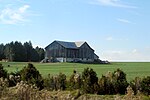
Salem is a Dispersed Rural Community and unincorporated place in the municipality of Mono, Dufferin County in southwestern Ontario, Canada. The community is located at the intersection of 2nd Line EHS and Sideroad 5, 5.3 kilometres (3.3 mi) northeast of the town of Orangeville.

Excerpt from the Wikipedia article Salem, Dufferin County, Ontario (License: CC BY-SA 3.0, Authors).

Salem, Dufferin County, Ontario
2nd Line EHS,

Geographical coordinates (GPS) Address Nearby Places
placeShow on map

Wikipedia: Salem, Dufferin County, OntarioContinue reading on Wikipedia

Geographical coordinates (GPS)

Latitude Longitude
N 43.956388888889 ° E -80.054722222222 °
placeShow on map

Address

2nd Line EHS 753298
L9W 6W6
Ontario, Canada
mapOpen on Google Maps

Share experience

Nearby Places

Upper Canada
Upper Canada

The Province of Upper Canada (French: province du Haut-Canada) was a part of British Canada established in 1791 by the Kingdom of Great Britain, to govern the central third of the lands in British North America, formerly part of the Province of Quebec since 1763. Upper Canada included all of modern-day Southern Ontario and all those areas of Northern Ontario in the Pays d'en Haut which had formed part of New France, essentially the watersheds of the Ottawa River or Lakes Huron and Superior, excluding any lands within the watershed of Hudson Bay. The "upper" prefix in the name reflects its geographic position along the Great Lakes, mostly above the headwaters of the Saint Lawrence River, contrasted with Lower Canada (present-day Quebec) to the northeast. Upper Canada was the primary destination of Loyalist refugees and settlers from the United States after the American Revolution, who often were granted land to settle in Upper Canada. Already populated by Indigenous peoples, land for settlement in Upper Canada was made by treaties between the new British government and the Indigenous, exchanging land for one-time payments or annuities. The new province was characterized by its British way of life, including bicameral parliament and separate civil and criminal law, rather than mixed as in Lower Canada or elsewhere in the British Empire. The division was created to ensure the exercise of the same rights and privileges enjoyed by loyal subjects elsewhere in the North American colonies. In 1812, war broke out between Great Britain and the United States, leading to several battles in Upper Canada. The United States attempted to capture Upper Canada, but the war ended with the situation unchanged. The government of the colony came to be dominated by a small group of persons, known as the "Family Compact", who held most of the top positions in the Legislative Council and appointed officials. In 1837, an unsuccessful rebellion attempted to overthrow the undemocratic system. Representative government would be established in the 1840s. Upper Canada existed from its establishment on 26 December 1791 to 10 February 1841, when it was united with adjacent Lower Canada to form the Province of Canada.
Southern Ontario
Southern Ontario

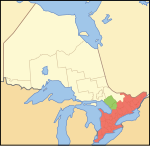
Southern Ontario is a primary region of the Canadian province of Ontario. It is the most densely populated and southernmost region in Canada, with approximately 13.5 million people, approximately 36% of Canada's population of 37 million. The region lies south of the province's other primary region, Northern Ontario, although the exact northern boundary of Southern Ontario is disputed. However, its core region is situated south of Algonquin Park, the latter being in an area of transition between coniferous forest north of the French and Mattawa Rivers and southern deciduous forest. It covers between 14 and 15% of the province, depending on the inclusion of the Parry Sound and Muskoka districts which also lie in the transitional area between northern and southern forest regions. Southern Ontario differs greatly from Northern Ontario, having a much higher population density, a different climate, and a different culture than its northern counterpart. It is broken into smaller subregions, including Central Ontario, Eastern Ontario, the Golden Horseshoe, and Southwestern Ontario. The core area of Southern Ontario is part of the Quebec City–Windsor Corridor, which extends northeast into southern Quebec. The transitional northern area of this primary region extends north to the Mattawa River and occupies part of the Grenville Geological Province of the Canadian Shield, which also extends northeast into southern Quebec; most of Northern Ontario lies within the Superior Geological Province.