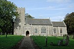
Honingham
BroadlandCivil parishes in NorfolkHoninghamNorfolk geography stubsVillages in Norfolk

Honingham is a village and civil parish in the English county of Norfolk, located 8 miles (13 km) to the west of Norwich along the A47 trunk road. It covers an area of 10.55 km2 (4.07 sq mi) and had a population of 342 in 145 households at the 2001 census, increasing to a population of 358 in 160 households at the 2011 Census. For the purposes of local government, it falls within the district of Broadland. Honingham Hall was demolished in 1966.The villages name means 'homestead/village of Huna's people'.
Excerpt from the Wikipedia article Honingham (License: CC BY-SA 3.0, Authors, Images).Honingham
Hall Drive, Broadland Honingham
Geographical coordinates (GPS) Address Nearby Places Show on map
Geographical coordinates (GPS)
| Latitude | Longitude |
|---|---|
| N 52.66345 ° | E 1.10838 ° |
Address
Hall Drive
Hall Drive
NR9 5AR Broadland, Honingham
England, United Kingdom
Open on Google Maps


