Tooley Street
Conservation areas in LondonStreets in the London Borough of SouthwarkUse British English from September 2017

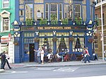
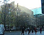
Tooley Street is a road in central and south London connecting London Bridge to St Saviour's Dock; it runs past Tower Bridge on the Southwark/Bermondsey side of the River Thames, and forms part of the A200 road. (grid reference TQ3380.)
Excerpt from the Wikipedia article Tooley Street (License: CC BY-SA 3.0, Authors, Images).Tooley Street
Shipwright Yard, London Borough (London Borough of Southwark)
Geographical coordinates (GPS) Address Nearby Places Show on map
Geographical coordinates (GPS)
| Latitude | Longitude |
|---|---|
| N 51.504655555556 ° | E -0.083605555555556 ° |
Address
Pizza Pilgrims
Shipwright Yard
SE1 2DA London, Borough (London Borough of Southwark)
England, United Kingdom
Open on Google Maps


