place

WDJM-FM

1972 establishments in MassachusettsCollege radio stations in MassachusettsFramingham, MassachusettsFramingham State UniversityMass media in Middlesex County, Massachusetts
Massachusetts radio station stubsRadio stations established in 1972Use mdy dates from March 2023

WDJM-FM (91.3 FM) is a radio station broadcasting a variety format. Licensed to Framingham, Massachusetts, United States, the station is owned by Framingham State University. The station was first licensed in 1972. Originally called WFSB, the station received new calls on December 17, 1973, after a donation from Post-Newsweek Stations, which asked for the calls to replace those of WTIC-TV in Hartford, Connecticut, to honor the president of their television station group as WFSB (Channel 3). The new calls for WDJM, in turn, honored the then-president of Framingham State College, D. Justin McCarthy. In 1984, the station was granted a power increase to 100 watts and has been operating at this power ever since. The station is currently located on the 4th floor of the D. Justin McCarthy College Center. Sid Schweiger, IT manager of WRKO as well as WDJM's engineer has been working at WDJM for over 30 years. WDJM offers a wide variety of student-run programming. DJs are granted two-hour time slots in which they can play an open format of music. Show formats range from classic rock, metal, electronic, dance, religious, reggae, hip-hop, sports, and more. When a show is not on the air, WDJM broadcasts programming from the Talking Information Center. Over the years, WDJM has hosted many events and activities on campus, ranging from dances to trivia nights to game nights and more. Beginning in the fall 2011 semester, WDJM began to stream its broadcasts on the internet. In the spring of 2023, the Center for Student Experience began advising the station to consider becoming an online-only outlet. The station would conduct a year-long trial of not using its FM facility, its executive board citing the ability to not have to consider FCC regulations and facility maintenance.

Excerpt from the Wikipedia article WDJM-FM (License: CC BY-SA 3.0, Authors).

WDJM-FM
Church Street, Framingham

Geographical coordinates (GPS) Address Nearby Places
placeShow on map

Wikipedia: WDJM-FMContinue reading on Wikipedia

Geographical coordinates (GPS)

Latitude Longitude
N 42.295638888889 ° E -71.437833333333 °
placeShow on map

Address

Church Street 13
01702 Framingham
Massachusetts, United States
mapOpen on Google Maps

Share experience

Nearby Places

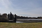
Framingham Reservoir No. 1 Dam and Gatehouse

The Framingham Reservoir No. 1 Dam and Gatehouse is a historic water works facility in Framingham, Massachusetts. This complex is located at the end of Framingham Reservoir No. 1, which is also known as the Stearns Reservoir, off Winter Street and north of Long Avenue. Constructed from 1876 to 1878 as part of an expansion of the water supply of the city of Boston, this was designed by its first city architect George A. Clough. The historical purpose of the reservoir, which was located at the confluence of two branches of the Sudbury River, was primarily to control the river's water level, and secondarily to provide reserve supply capacity. The reservoir's reserve capacity was generally used only as a backup supply, as the reservoir's muddy bottom made it a less desirable source than reservoir No. 3 upstream. However the reservoir No. 1 system was nonetheless important due to its role in controlling the flow of the river downstream, and due to the gatehouse which controlled the water flows for all the Framingham reservoirs into the Sudbury Aqueduct. Reservoir No. 1 is no longer maintained as a reserve water source, although it is still owned by the Massachusetts Water Resources Authority, successor to the Boston Water Board which oversaw its construction. MWRA retains ownership as the gatehouse contains the connection between Reservoir No. 3 and the Sudbury Aqueudct which remain part of the emergency water systems.The dam measures 793 feet (242 m) in length, with an overfall area that is 169 feet (52 m) long. The embankments are 20 feet (6.1 m) wide, with a core of granite rubble laid in cement. The overfall area is topped with cut granite, and originally had wooden flashboards held in by pins. The gatehouse is a 1+1⁄2-story granite structure, designed by Boston city architect George Clough. Located at the southern end of the overfall, it houses one end of the Sudbury Aqueduct extension pipe from Farm Pond, a 4-foot (1.2 m) pipe connecting this reservoir to numbers 2 and 3, and gates for channeling water either into the aqueduct or into the river. The gates allowed water to be selectively channeled from any of the reservoirs (1, 2, or 3) into the Sudbury Aqueduct or into the river below the dam. There are also flood gates and equipment for moving the dam's flashboards. Today the gatehouse, Sudbury Aqueduct, and the pipes from reservoir number 3 remain part of MWRA's emergency systems. If activated, the water from reservoir number 3 flows from the dam number 1 gatehouse down the Sudbury Aqueduct extension pipe to a gatehouse at Farm Pond where it enters the Sudbury Aqueduct proper which in turn brings the water to the Chestnut Hill Reservoir.The dam and gatehouse were listed on the National Register of Historic Places in 1990.