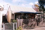
Tempe, New South Wales
Inner WestSuburbs of SydneyTempe, New South WalesUse Australian English from August 2019

Tempe ( tem-PEE;) is a suburb in the Inner West of Sydney, in the state of New South Wales, Australia. Tempe is located 9 kilometres south of the Sydney central business district in the local government area of Inner West Council. Tempe sits on the northern bank of the Cooks River and is separated from Sydney Airport by the Alexandra Canal, also known as Sheas Creek. The Wolli Creek waterway also empties into the Cooks River.
Excerpt from the Wikipedia article Tempe, New South Wales (License: CC BY-SA 3.0, Authors, Images).Tempe, New South Wales
Station Street West, Sydney Tempe
Geographical coordinates (GPS) Address Nearby Places Show on map
Geographical coordinates (GPS)
| Latitude | Longitude |
|---|---|
| N -33.925277777778 ° | E 151.15833333333 ° |
Address
Station Street West
Station Street West
2044 Sydney, Tempe
New South Wales, Australia
Open on Google Maps


