place

Alameda Mole

1878 establishments in CaliforniaBuildings and structures in Alameda, CaliforniaDemolished railway stations in the United StatesFerry terminals in the San Francisco Bay AreaFormer railway stations in California
Piers in CaliforniaRailway stations in Alameda County, CaliforniaRailway stations in the United States opened in 1878Transportation buildings and structures in Alameda County, California
Alameda Mole facing east, October 2017

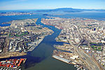
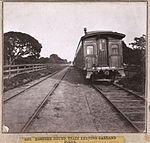
The Alameda Mole was a transit and transportation facility in Alameda, California for ferries landing in the East Bay of San Francisco from 1878 to the 1930s. It was located on the west end of Alameda, and later became part of the Alameda Naval Air Station. It was one of four neighbouring moles. The others were the Oakland Mole, the WP Mole (Western Pacific), and the Key System Mole. The purpose of the mole was to extend tracks of rail-based transportation lines beyond the shallow mud flats along the shore of the East Bay into water deep enough to accommodate the passenger and rail ferries to San Francisco.

Excerpt from the Wikipedia article Alameda Mole (License: CC BY-SA 3.0, Authors, Images).

Alameda Mole
Airfield Perimeter Road,

Geographical coordinates (GPS) Address Nearby Places
placeShow on map

Wikipedia: Alameda MoleContinue reading on Wikipedia

Geographical coordinates (GPS)

Latitude Longitude
N 37.796 ° E -122.329 °
placeShow on map

Address

Airfield Perimeter Road

Airfield Perimeter Road
94110
California, United States
mapOpen on Google Maps

Alameda Mole facing east, October 2017
Share experience

Nearby Places

San Francisco–Oakland Bay Bridge

The San Francisco–Oakland Bay Bridge, known locally as the Bay Bridge, is a complex of bridges spanning San Francisco Bay in California. As part of Interstate 80 and the direct road between San Francisco and Oakland, it carries about 260,000 vehicles a day on its two decks. It has one of the longest spans in the United States. The toll bridge was conceived as early as the California Gold Rush days, with "Emperor" Joshua Norton famously advocating for it, but construction did not begin until 1933. Designed by Charles H. Purcell, and built by American Bridge Company, it opened on Thursday, November 12, 1936, six months before the Golden Gate Bridge. It originally carried automobile traffic on its upper deck, with trucks, cars, buses and commuter trains on the lower, but after the Key System abandoned rail service, the lower deck was converted to all-road traffic as well. In 1986, the bridge was unofficially dedicated to James Rolph.The bridge has two sections of roughly equal length; the older western section, officially known as the Willie L. Brown Jr. Bridge (after former San Francisco Mayor and California State Assembly Speaker Willie L. Brown Jr.), connects downtown San Francisco to Yerba Buena Island, and the newer unnamed eastern section connects the island to Oakland. The western section is a double suspension bridge with two decks, westbound traffic being carried on the upper deck while eastbound is carried on the lower one. The largest span of the original eastern section was a cantilever bridge. During the 1989 Loma Prieta earthquake, a portion of the eastern section's upper deck collapsed onto the lower deck and the bridge was closed for a month. Reconstruction of the eastern section of the bridge as a causeway connected to a self-anchored suspension bridge began in 2002; the new eastern section opened September 2, 2013, at a reported cost of over $6.5 billion; the original estimate of $250 million was for a seismic retrofit of the existing span. Unlike the western section and the original eastern section of the bridge, the new eastern section is a single deck carrying all eastbound and westbound lanes, making it the world's widest bridge, according to Guinness World Records, as of 2014. Demolition of the old east span was completed on September 8, 2018.