place

Capilano River

Canyons and gorges of British ColumbiaNew Westminster Land DistrictNorth Vancouver (district municipality)Rivers of the Lower MainlandRivers of the Pacific Ranges
West Vancouver
CapilanoRiverRegPark river

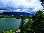
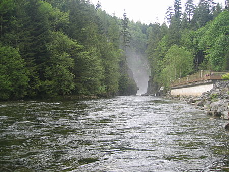
The Capilano River flows from north to south through the Coast Mountains on Vancouver's North Shore between West Vancouver and North Vancouver (district municipality) and empties into Burrard Inlet, opposite Stanley Park. The river is one of three primary sources of drinking water for residents of Greater Vancouver, and flows through the Capilano watershed. The Cleveland Dam, built in 1954, impounds a reservoir for this purpose. The entire area of the reservoir and watershed area upstream of the dam is closed to the public to ensure the quality of the drinking water. Prior to construction of the Cleveland Dam, the Capilano River deposited large amounts of sediment into Burrard Inlet. A dredge was needed to remove this sediment build-up in order to keep Burrard Inlet open for ship traffic. The Capilano has a historic salmon run which was impacted by the dam construction. In 1971 the Capilano Fish hatchery was opened. It was built 1/2 kilometre (km) downstream of the dam to ensure the survival of the run. Beyond strengthening the salmon stocks from the aftermath of the dam, the hatchery’s work also introduced chinook to the system in an attempt to establish a self-sustaining run. The river flows through coastal rainforest and, in its lower stretches, follows a granite canyon with walls in excess of 40 metres tall in places. The Capilano flows during periods of snow melt and rainfall mainly and slows to a trickle at other times. The origin of the name Capilano River is obscure. The name is thought to be an anglicized form of names that were Squamish and Musqueam. The last man known as Chief Capilano died in 1870.: 38 

Excerpt from the Wikipedia article Capilano River (License: CC BY-SA 3.0, Authors, Images).

Capilano River
Spirit Trail, West Vancouver Park Royal

Geographical coordinates (GPS) Address Nearby Places
placeShow on map

Wikipedia: Capilano RiverContinue reading on Wikipedia

Geographical coordinates (GPS)

Latitude Longitude
N 49.321111111111 ° E -123.13944444444 °
placeShow on map

Address

Spirit Trail

Spirit Trail
V7T 2W4 West Vancouver, Park Royal
British Columbia, Canada
mapOpen on Google Maps

CapilanoRiverRegPark river
Share experience

Nearby Places

Park Royal Shopping Centre

Park Royal Shopping Centre, also known as simply Park Royal, opened in 1950, is a shopping mall located in West Vancouver and X̱wemelch'stn, British Columbia, Canada. Park Royal was Canada's first covered shopping mall. Park Royal has seen multiple redeveloped projects within the last decade. Notably, in 2014, the district of West Vancouver approved a permit for the "removal of the storefront fabric canopies, faux columns and related ‘nautical’ theme designs" as well as the re-facing of the building to "create a cohesive look between Park Royal North and Park Royal South." The shopping centre was originally anchored by Woodward's. The Centre was started alongside the Guinness family's British Properties developments nearby, and was named after the London suburb of Park Royal where a Guinness brewery stood. The Guinnesses sold it in 1986. The mall is physically divided into two locations by Marine Drive, a major thoroughfare on the North Shore. The two sides are aptly named North Mall and South Mall, and are connected by 2 main intersections: Main St - Marine Drive, and Taylor Way - Marine Drive, as well as an overpass next to Shoppers Drug Mart. The North Mall is the original part of the mall, and had the anchor store Woodward's (on the East end) and Woodward's Food Floors (on the West end). Expansion to the South Mall occurred in the 1962 with a further development in the mid-1970s. The expansion in the 1960s added SuperValu and Eaton's as the anchor stores on the South Mall. Further expansion in the mid-1970s added a second floor to the mall and the Hudson's Bay store. In 1993 when Woodward's closed, The Bay moved into the location previously held by Woodward's, and the Food Floor was converted into a Government Liquor Store, London Drugs and Rogers Video (now closed). The entire mall covers roughly 1.4 million square feet.

Lions Gate Bridge
Lions Gate Bridge

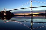
The Lions Gate Bridge, opened in 1938 and officially known as the First Narrows Bridge, is a suspension bridge that crosses the first narrows of Burrard Inlet and connects the City of Vancouver, British Columbia, to the North Shore municipalities of the District of North Vancouver, the City of North Vancouver, and West Vancouver. The term "Lions Gate" refers to the Lions, a pair of mountain peaks north of Vancouver. Northbound traffic on the bridge heads in their general direction. A pair of cast concrete lions, designed by sculptor Charles Marega, were placed on either side of the south approach to the bridge in January 1939.The total length of the bridge including the north viaduct is 1,823 metres (5,981 ft). The length including approach spans is 1,517.3 metres (4,978 ft), the main span alone is 473 metres (1,552 ft), the tower height is 111 metres (364 ft), and it has a ship's clearance of 61 metres (200 ft). Prospect Point in Stanley Park offered a good high south end to the bridge, but the low flat delta land to the north required construction of the extensive North Viaduct. The bridge has three lanes, with the middle being a reversible lane indicated by signals. The centre lane changes direction to accommodate for traffic patterns. The traffic volume on the bridge is 60,000–70,000 vehicles per day. Trucks exceeding 13 tonnes (12.8 long tons; 14.3 short tons) are prohibited, as are vehicles using studded tires. The bridge forms part of Highways 99 and 1A. On March 24, 2005, the Lions Gate Bridge was designated a National Historic Site of Canada.