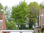
Sharpthorne
Mid Sussex DistrictVillages in West SussexWest Sussex geography stubs

Sharpthorne is a village in the Mid Sussex District of West Sussex, South-East England. It lies on the West Hoathly to Forest Row road 3.8 miles (6.2 km) south of East Grinstead. The Bluebell Railway runs through a 731 yards (668 m) long tunnel underneath the village, the longest on a preserved Standard Railway put-together.
Excerpt from the Wikipedia article Sharpthorne (License: CC BY-SA 3.0, Authors, Images).Sharpthorne
Top Road, Mid Sussex
Geographical coordinates (GPS) Address Nearby Places Show on map
Geographical coordinates (GPS)
| Latitude | Longitude |
|---|---|
| N 51.07478 ° | E -0.04136 ° |
Address
Top Road
Top Road
RH19 4NS Mid Sussex
England, United Kingdom
Open on Google Maps


