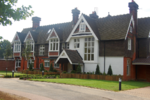
Handcross

Handcross is a village in the Mid Sussex District of West Sussex, England. It lies on the A23 road 4.2 miles (6.8 kilometres) south of Crawley. At the 2011 Census the population fell within the civil parish of Slaugham. Nymans Garden, 30 acres (12 hectares) of parklands run by the National Trust, is located adjacent to the High Street, as are 20 acres (8 ha) of woodland and water gardens at High Beeches Garden.Handcross has one public house, The Red Lion (High Street), which was refurbished in 2010 in contemporary style. It formerly had three, the other two being The Fountain (demolished in 2012 and replaced by housing) and The Royal Oak (closed in 2020). This is now due to re-open in 2023, Handcross also has a Social club. Handcross Primary School, situated at the northern end of the village recently underwent extensive building works to increase capacity. Opposite the primary school is Handcross Park School, an independent prep school.
Excerpt from the Wikipedia article Handcross (License: CC BY-SA 3.0, Authors, Images).Handcross
Horsham Road, Mid Sussex
Geographical coordinates (GPS) Address Nearby Places Show on map
Geographical coordinates (GPS)
| Latitude | Longitude |
|---|---|
| N 51.05356 ° | E -0.20044 ° |
Address
Horsham Road
Horsham Road
RH17 6BP Mid Sussex
England, United Kingdom
Open on Google Maps


