Walderton
EngvarB from September 2013Villages in West SussexWest Sussex geography stubs

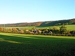
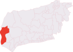
Walderton is a hamlet in the Chichester district of West Sussex, England. It lies on the B2146 road 4 miles (6.4 km) northeast of Emsworth. It is in the civil parish of Stoughton. The village lies just below the source of the River Ems. It is crossed by the Monarch's Way long-distance footpath.
Excerpt from the Wikipedia article Walderton (License: CC BY-SA 3.0, Authors, Images).Walderton
Cooks Lane, Chichester Stoughton
Geographical coordinates (GPS) Address Nearby Places Show on map
Geographical coordinates (GPS)
| Latitude | Longitude |
|---|---|
| N 50.89031 ° | E -0.87714 ° |
Address
Cooks Lane
Cooks Lane
PO18 9EF Chichester, Stoughton
England, United Kingdom
Open on Google Maps


