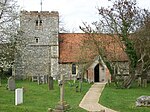
Southend, Buckinghamshire
Buckinghamshire geography stubsHamlets in Buckinghamshire

Southend is a hamlet, in the civil parish of Turville (where at the 2011 Census the population was included ) near to the village of the same name in Buckinghamshire, England. It lies in the Chiltern Hills at an elevation of 188m near the Oxfordshire border above and to the west of the Hambleden Valley. There are some houses and cottages around a rough village green and two small ponds.
Excerpt from the Wikipedia article Southend, Buckinghamshire (License: CC BY-SA 3.0, Authors, Images).Southend, Buckinghamshire
Geographical coordinates (GPS) Address Nearby Places Show on map
Geographical coordinates (GPS)
| Latitude | Longitude |
|---|---|
| N 51.601086 ° | E -0.913381 ° |
Address
RG9 6JP , Turville
England, United Kingdom
Open on Google Maps


