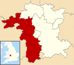
Leigh, Worcestershire

Leigh is a village and civil parish (with a parish council shared with Bransford) in the Malvern Hills district of the county of Worcestershire, England. With just a few hundred inhabitants the parish lies on the A4103, the main Worcester to Hereford road, about 5 miles out of Worcester, whilst Malvern is also about 5 miles away. The parish includes Leigh, Brockamin, Leigh Sinton, Sandlin & Smith End Green. The local pronunciation is that the name rhymes with "lie". Due largely to the significant reduction of the hop industry in the area,Leigh, like many local villages, declined in the late 20th century; it lost its pub, its police station and its railway station (with the closure of the Bromyard branch line in the 1960s).
Excerpt from the Wikipedia article Leigh, Worcestershire (License: CC BY-SA 3.0, Authors, Images).Leigh, Worcestershire
Malvern Hills District
Geographical coordinates (GPS) Address Nearby Places Show on map
Geographical coordinates (GPS)
| Latitude | Longitude |
|---|---|
| N 52.1789 ° | E -2.318 ° |
Address
WR6 5LB Malvern Hills District
England, United Kingdom
Open on Google Maps


