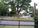
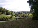
Malvern Hills District
1998 establishments in EnglandMalvern, WorcestershireMalvern Hills DistrictNon-metropolitan districts of WorcestershirePages with non-numeric formatnum arguments ... and 1 more
Use British English from July 2013

Malvern Hills is a local government district in Worcestershire, England. Its council is based in the town of Malvern, and its area covers most of the western half of the county, including the outlying towns of Tenbury Wells and Upton-upon-Severn. It was originally formed in 1974 and was subject to a significant boundary reform in 1998. In the 2011 census the population of the Malvern Hills district was 74,631.
Excerpt from the Wikipedia article Malvern Hills District (License: CC BY-SA 3.0, Authors, Images).Malvern Hills District
Malvern Hills District
Geographical coordinates (GPS) Address Nearby Places Show on map
Geographical coordinates (GPS)
| Latitude | Longitude |
|---|---|
| N 52.18 ° | E -2.34 ° |
Address
WR6 5JX Malvern Hills District
England, United Kingdom
Open on Google Maps


