Bransford

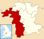
Bransford is a village and civil parish in the Malvern Hills district of the county of Worcestershire, England. It is situated close to the River Teme and the village of Leigh. It is on the primary route between Worcester and Hereford, the A4103 that runs through the centre of the village. According to the 2011 census, Bransford has a population of 389. The parish shares its parish council with Leigh. The main church in Bransford is St. Johns the Baptist church, a small Norman building, lit by candlelight. Bransford is part of the West Worcestershire parliamentary constituency and its current Member of Parliament is Harriet Baldwin, who is a Conservative representative.
Excerpt from the Wikipedia article Bransford (License: CC BY-SA 3.0, Authors, Images).Bransford
Suckley Road, Malvern Hills District
Geographical coordinates (GPS) Address Nearby Places Show on map
Geographical coordinates (GPS)
| Latitude | Longitude |
|---|---|
| N 52.166667 ° | E -2.316667 ° |
Address
Suckley Road
Suckley Road
WR6 5LG Malvern Hills District
England, United Kingdom
Open on Google Maps


