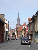
Kortemark
Municipalities of West FlandersPages with Dutch IPAWest Flanders geography stubs

Kortemark (Dutch pronunciation: [ˈkɔrtəmɑr(ə)k]), also previously Cortemarck, is a municipality located in the Belgian province of West Flanders. The municipality comprises the towns of Handzame, Kortemark, Werken and Zarren. On January 1, 2006, Kortemark had a total population of 11,976. The total area is 55.00 km² which gives a population density of 218 inhabitants per km².
Excerpt from the Wikipedia article Kortemark (License: CC BY-SA 3.0, Authors, Images).Kortemark
Sneppestraat,
Geographical coordinates (GPS) Address Nearby Places Show on map
Geographical coordinates (GPS)
| Latitude | Longitude |
|---|---|
| N 51.033333333333 ° | E 3.0333333333333 ° |
Address
Sneppestraat 49
8610 (Kortemark)
West Flanders, Belgium
Open on Google Maps


