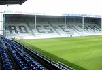
Torhout
Municipalities of West FlandersPages with Dutch IPATorhoutWest Flanders geography stubs

Torhout (Dutch pronunciation: [ˈtɔrɦʌu̯t]; French: Thourout; West Flemish: Toeroet) is a city and municipality located in the Belgian province of West Flanders. The municipality comprises the city of Torhout proper, the villages of Wijnendale and Sint-Henricus, and the hamlet of De Driekoningen. On January 1, 2012, Torhout had a total population of 20,149. The total area is 45.23 km² which gives a population density of 445 inhabitants per km².
Excerpt from the Wikipedia article Torhout (License: CC BY-SA 3.0, Authors, Images).Torhout
Allée de Pen Ruic, Quimper
Geographical coordinates (GPS) Address Nearby Places Show on map
Geographical coordinates (GPS)
| Latitude | Longitude |
|---|---|
| N 51.05 ° | E 3.1 ° |
Address
Allée de Pen Ruic 8
29000 Quimper, Penvillers
Bretagne, France
Open on Google Maps


