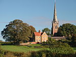
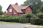
Braunston Cleves or Fawcliff
Former populated places in Northamptonshire

The village of Braunston Cleves or Fawcliff formerly stood north of the village of Braunston in the English county of Northamptonshire at its border with Warwickshire. It has long been a "lost village", having no standing buildings, but its position and the topography of its street and houses can be traced from the irregularities of the ground where it formerly stood. It was on the southwest slope of Cleve's Hill within Braunston parish: it appears to have been occupied in late Anglo-Saxon and early post-Conquest times. Nothing is known of why the village was deserted but it had certainly been destroyed by the 18th century.
Excerpt from the Wikipedia article Braunston Cleves or Fawcliff (License: CC BY-SA 3.0, Authors, Images).Braunston Cleves or Fawcliff
Barby Lane,
Geographical coordinates (GPS) Address Nearby Places Show on map
Geographical coordinates (GPS)
| Latitude | Longitude |
|---|---|
| N 52.308333333333 ° | E -1.2027777777778 ° |
Address
Barby Lane
Barby Lane
NN11 7AF , Braunston
England, United Kingdom
Open on Google Maps


