place

Portland International Airport

1936 establishments in OregonAirports established in 1936Airports in Multnomah County, OregonAirports in Portland, OregonNortheast Portland, Oregon
Pages with disabled graphsPort of Portland (Oregon)Portal templates with redlinked portalsPortland International AirportUse mdy dates from January 2024Wikipedia pages semi-protected from banned usersWorks Progress Administration in Oregon
Portland International Airport Aerial August 2022

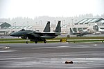
Portland International Airport (IATA: PDX, ICAO: KPDX, FAA LID: PDX) is a joint civil–military airport and the largest airport in the U.S. state of Oregon, accounting for 90% of the state's passenger air travel and more than 95% of its air cargo. It is within Portland's city limits just south of the Columbia River in Multnomah County, 6 miles (10 kilometers) by air and 12 mi (19 km) by highway northeast of downtown Portland. Portland International Airport is often referred to by its IATA airport code, PDX. The airport covers 3,000 acres (1,214 ha) of land.Portland International Airport has direct flights to cities throughout the United States and in several other countries, including Canada, Mexico, Germany, United Kingdom, the Netherlands, and Iceland. The airport is a hub for Alaska Airlines. It also has a maintenance facility for Alaska Air subsidiary Horizon Air. General aviation services are provided at PDX by Atlantic Aviation. The Oregon Air National Guard has a base on the southwest portion of the airport property grounds, and is also the host unit of the 142nd Fighter Wing (142 FW), which operates the F-15 Eagle. Local transportation includes the MAX Red Line light rail, which takes passengers between PDX and downtown Portland, as well as farther west to Beaverton. There is also Interstate 205, which connects to southwestern Washington (north from PDX) along with many suburbs of Portland (south from PDX).

Excerpt from the Wikipedia article Portland International Airport (License: CC BY-SA 3.0, Authors, Images).

Portland International Airport
Northeast Airport Way, Portland

Geographical coordinates (GPS) Address Nearby Places
placeShow on map

Wikipedia: Portland International AirportContinue reading on Wikipedia

Geographical coordinates (GPS)

Latitude Longitude
N 45.588611111111 ° E -122.5975 °
placeShow on map

Address

Northeast Airport Way
97238 Portland
Oregon, United States
mapOpen on Google Maps

Portland International Airport Aerial August 2022
Share experience

Nearby Places

Northeast Portland, Oregon

Northeast Portland is one of the six major divisions of Portland, Oregon. Northeast Portland contains a diverse collection of neighborhoods. For example, while Irvington and the Alameda Ridge feature some of the oldest and most expensive homes in Portland, nearby King is a more working-class neighborhood. Because it is so large, Northeast Portland can essentially be divided ethnically, culturally, and geographically into inner and outer sections. The inner Northeast neighborhoods that surround Martin Luther King Jr. Blvd. were once predominantly African-American, resembling typical urban inner-city environments found in most major U.S. cities. However, the demographics are now changing due to the process of gentrification. In 2010, the King neighborhood was 25.9% Black or African-American, a 41.3% decrease since 2000. Inner Northeast includes several shopping areas, such as the Lloyd District, Alberta Arts District (Portland, Oregon) and Hollywood, and part of the affluent Irvington, Alameda, Grant Park, Sullivan's Gulch and Laurelhurst neighborhoods and nearby developments. The city plan targets Lloyd District as another mixed-use area, with high-density residential development.At the base of Northeast where its border meets Southeast, an area near the Burnside Bridge has been redeveloped into a bustling nightlife and entertainment district. By 2006, the area was established enough to get its own nickname: LoBU, in reference to Lower (numerically) Burnside.