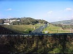
Tonteg

Tonteg is a village around three and a half miles (6 km) from Pontypridd, south Wales. It is 9 miles (14.5 km) north west of Cardiff and four miles (6.5 km) north east of Llantrisant. The village is within the community of Llantwit Fardre. Tonteg is to the north west of the Garth Mountain, on the west side of the River Taff valley, at the top of a hill known locally as Powerstation Hill. The hill gets its name from the Upper Boat power station which was situated at the bottom of the hill until it was demolished in 1972. Tonteg is next to Church Village and the boundaries between the two villages are blurred. A significant part of the Treforest Industrial Estate falls within the Willowford area of Tonteg.
Excerpt from the Wikipedia article Tonteg (License: CC BY-SA 3.0, Authors, Images).Tonteg
Lansdale Drive,
Geographical coordinates (GPS) Address Nearby Places Show on map
Geographical coordinates (GPS)
| Latitude | Longitude |
|---|---|
| N 51.5679 ° | E -3.308 ° |
Address
Lansdale Drive
Lansdale Drive
CF38 1NN , Llantwit Fardre
Wales, United Kingdom
Open on Google Maps


