place

Bloomers Hole Footbridge

Bridges completed in 2000Bridges in OxfordshireOxfordshire geography stubsPedestrian bridges across the River ThamesUse British English from June 2015
Bloomers Hole Footbridge

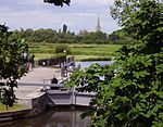
Bloomers Hole Footbridge is a footbridge across the River Thames in Oxfordshire, England. It is situated on the reach above Buscot Lock and was installed in 2000 to carry the Thames Path across the Thames. It is built of steel encased in wood to make it look like a timber structure. The Countryside Agency commissioned Oxfordshire County Council to design and build the bridge and the design was undertaken by Charlie Benner, the senior engineer. The bridge was installed in 2000. The two 27-metre (89 ft) 8-tonne steel beams were put in place by a Chinook helicopter from RAF Brize Norton.Bloomer's Hole is at a wide bend about quarter of a mile downstream of St John's Lock. The river winds tortuously along here, and although a cut of the river across Bloomer Meadow was mooted as early as 1802, it was never implemented.

Excerpt from the Wikipedia article Bloomers Hole Footbridge (License: CC BY-SA 3.0, Authors, Images).

Bloomers Hole Footbridge
Bloomers Hole Footbridge, Vale of White Horse

Geographical coordinates (GPS) Address External links Nearby Places
placeShow on map

Wikipedia: Bloomers Hole FootbridgeContinue reading on Wikipedia

Geographical coordinates (GPS)

Latitude Longitude
N 51.686611 ° E -1.675929 °
placeShow on map

Address

Bloomers Hole Footbridge

Bloomers Hole Footbridge
GL7 3HR Vale of White Horse
England, United Kingdom
mapOpen on Google Maps

linkWikiData (Q4928206)
linkOpenStreetMap (131883443)

Bloomers Hole Footbridge
Share experience

Nearby Places

Halfpenny Bridge
Halfpenny Bridge

Halfpenny Bridge is a bridge across the River Thames, at Lechlade, Gloucestershire, England. The bridge and its toll house are a Grade II listed building. It marks the start of the navigable Thames, although if the waters are high, the Thames can continue to be travelled by small and unpowered craft as far as Cricklade, over 10 miles (16 km) South-west. The bow-backed bridge was built to a design of James Hollingworth in 1792. It carries the A361 from the south into Lechlade. It was called the Halfpenny bridge because that was the toll charged for pedestrians to cross it, until the toll was done away with in 1839. The A361 is called Thames Street at this point, and the bridge was built when Thames Street was laid out. The structure is around 20 feet (6 m) wide and the single arch is nearly 26 feet (8 m) high to its apex. On the north bank of the river, a small square toll house is attached to the bridge on the downstream side. It consists of a basement and a room at road level, with a pyramidal asbestos slate roof. Both the bridge and the toll house are grade II listed. It is thought that a local firm of builders called Ralph and Crowdy were responsible for its construction. There is a separate arch in the south causeway, through which the towpath passes, and both parapets carry a central panel with a line on it, to mark the county boundary between Wiltshire and Gloucestershire. In June 2023, a driver crashed into the eastern parapet causing substantial damage to the structure. The bridge is expected to remain closed to traffic for some months.A local micro-brewery based in Lechlade, The Halfpenny Brewery, is named after the bridge.