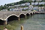
Liskeard and Looe Union Canal
1827 establishments in EnglandCanals in CornwallCanals opened in 1827Geographic coordinate listsIndustrial archaeological sites in Cornwall ... and 2 more
Lists of coordinatesUse British English from December 2016

The Liskeard and Looe Union Canal was a broad canal between Liskeard and Looe in Cornwall, United Kingdom. It was almost 6 miles (9.7 km) long and had 24 locks, and it opened progressively from 1827. The engineer was Robert Coad. Its primary purpose originally was the carriage of sea sand and lime to improve the acidic soil of agricultural lands, but when mineral deposits on Caradon Hill were exploited, it benefited considerably, carrying the mineral down to Looe Harbour. The trade increased so much that a railway—the Liskeard and Looe Railway—was built alongside its course by the Canal Company, and the canal itself gradually ceased to be navigable.
Excerpt from the Wikipedia article Liskeard and Looe Union Canal (License: CC BY-SA 3.0, Authors, Images).Liskeard and Looe Union Canal
Geographical coordinates (GPS) Address Nearby Places Show on map
Geographical coordinates (GPS)
| Latitude | Longitude |
|---|---|
| N 50.374722222222 ° | E -4.4641666666667 ° |
Address
PL13 1PH , Morval
England, United Kingdom
Open on Google Maps


