Colesbourne is a village and civil parish in the Cotswold district of Gloucestershire, England. The village and parish lies within the Cotswolds, a designated Area of Outstanding Natural Beauty.
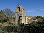
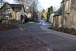
The village is 10 miles (16 km) east-southeast from the city and county town of Gloucester, and on a 1,000 yards (900 m) east to west section (defined by road entry signs) of the A435 road, which runs locally between Cheltenham 6 miles (10 km) to the north, and Cirencester, 7 miles (11 km) to the south. The civil parish is 4.5 miles (7 km) from north to south. Withington parish is at the north and north-east, with North Cerney and Rendcomb at the south. At the north-west is Coberley parish; at the west, Elkstone; and at the east, Chedworth. The River Churn flows through the centre of the parish and at the north of the village, where it is joined by its tributary Hilcot Brook, which rises in the farther north parish of Dowdeswell.The village contains The Chequers Inn public house, adjacent to a restaurant, a roadside fuel station, and a village farm with a small retail park which includes a cookery school and wine merchant. At the north of the village is the parish church of St James, and north from this the house of Colesbourne Park estate. Within the parish is a game shoot estate. Colesbourne is connected by bus to Cheltenham and Swindon.In 1872 John Marius Wilson recorded Colesbourne as being a parish in the Cirencester district, near the highest source of the River Thames and 3 miles (5 km) east from the Roman road of "Ermine-street", actually Ermin Way (today's A417). Remains of a Roman villa had been found. There was a post office and fifty-two houses in a parish area of 2,200 acres (9 km2). Colesbourne House was the seat of Henry John Elwes, who was patron of the ecclesiastical parish rectory.


