place

Colesbourne

Civil parishes in GloucestershireCotswold DistrictUse British English from January 2019Villages in Gloucestershire
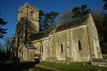
Colesbourne church geograph.org.uk 129381

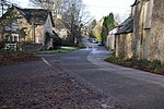
Colesbourne is a village and civil parish in the Cotswold district of Gloucestershire, England. The village and parish lies within the Cotswolds, a designated Area of Outstanding Natural Beauty. The village is 10 miles (16 km) east-southeast from the city and county town of Gloucester, and on a 1,000 yards (900 m) east to west section (defined by road entry signs) of the A435 road, which runs locally between Cheltenham 6 miles (10 km) to the north, and Cirencester, 7 miles (11 km) to the south. The civil parish is 4.5 miles (7 km) from north to south. Withington parish is at the north and north-east, with North Cerney and Rendcomb at the south. At the north-west is Coberley parish; at the west, Elkstone; and at the east, Chedworth. The River Churn flows through the centre of the parish and at the north of the village, where it is joined by its tributary Hilcot Brook, which rises in the farther north parish of Dowdeswell.The village contains The Chequers Inn public house, adjacent to a restaurant, a roadside fuel station, and a village farm with a small retail park which includes a cookery school and wine merchant. At the north of the village is the parish church of St James, and north from this the house of Colesbourne Park estate. Within the parish is a game shoot estate. Colesbourne is connected by bus to Cheltenham and Swindon.In 1872 John Marius Wilson recorded Colesbourne as being a parish in the Cirencester district, near the highest source of the River Thames and 3 miles (5 km) east from the Roman road of "Ermine-street", actually Ermin Way (today's A417). Remains of a Roman villa had been found. There was a post office and fifty-two houses in a parish area of 2,200 acres (9 km2). Colesbourne House was the seat of Henry John Elwes, who was patron of the ecclesiastical parish rectory.

Excerpt from the Wikipedia article Colesbourne (License: CC BY-SA 3.0, Authors, Images).

Colesbourne
Cheltenham Road, Cotswold District Colesbourne

Geographical coordinates (GPS) Address Nearby Places
placeShow on map

Wikipedia: ColesbourneContinue reading on Wikipedia

Geographical coordinates (GPS)

Latitude Longitude
N 51.818 ° E -2.00213 °
placeShow on map

Address

Colesbourne Inn

Cheltenham Road
GL53 9NP Cotswold District, Colesbourne
England, United Kingdom
mapOpen on Google Maps

Colesbourne church geograph.org.uk 129381
Share experience

Nearby Places

Cotswolds
Cotswolds

The Cotswolds ( KOTS-wohldz, KOTS-wəldz) is a region in central, South East, but predominantly South West England, along a range of rolling hills that rise from the meadows of the upper River Thames to an escarpment above the Severn Valley, Bath and Evesham Vale. The area is defined by the bedrock of Jurassic limestone that creates a type of grassland habitat rare in the UK and that is quarried for the golden-coloured Cotswold stone. The predominantly rural landscape contains stone-built villages, towns, stately homes and gardens featuring the local stone. Designated as an Area of Outstanding Natural Beauty (AONB) in 1966, the Cotswolds covers 787 square miles (2,038 km2), making it the largest AONB. It is England's third-largest protected landscape, after the Lake District and Yorkshire Dales national parks. Its boundaries are roughly 25 miles (40 km) across and 90 miles (140 km) long, stretching south-west from just south of Stratford-upon-Avon to just south of Bath, near Radstock. It lies across the boundaries of several English counties; mainly Gloucestershire and Oxfordshire, and parts of Wiltshire, Somerset, Worcestershire, and Warwickshire. The region's highest point is Cleeve Hill at 1,083 ft (330 m), just east of Cheltenham. The hills give their name to the Cotswold local government district, formed on 1 April 1974, within the county of Gloucestershire. Its main town is Cirencester, where the Cotswold District Council offices are. As of 2021, the population of the 450-square-mile (1,200 km2) district was about 91,000 . The much larger area referred to as the Cotswolds encompasses nearly 800 square miles (2,100 km2). The population of the Area of Outstanding Natural Beauty was 139,000 in 2016.

Withington, Gloucestershire

Withington is a Cotswold village and civil parish in Gloucestershire, England, about 7 miles (11 km) southeast of Cheltenham and 8 miles (13 km) north of Cirencester. The River Coln runs through the village. The parish includes the hamlets of Hilcot, Foxcote and Cassey Compton. The parish population taken at the 2011 census was 532.The site of a Roman villa lies to the south of the village. Remains of the villa were rediscovered in 1811 by Samuel Lysons, and investigations by the Time Team television programme for an episode first broadcast in 2006 found further Romano-British buildings east of the villa, towards the river.The origin of the name is unclear but it is found in records as early as 737 AD (Wudiandun, which would mean the hill of Wudia: Wudia may be a real settler or the legendary Germanic hero Witege). The other English places called Withington may have different origins. In his 1955 work, H. P. R. Finberg argued for continuity between Anglo-Saxon Withington and an earlier Roman settlement. During Saxon times there was an important monastery at Withington. The parish church of St Michael and All Angels dates from the 12th century and is a Grade I listed building. The church was altered in the 15th century when the Perpendicular clerestory and higher tower were added, and has been described as "a typical example of an important Cotswold church".From 1891 to 1961, Withington had a railway station on the Midland and South Western Junction Railway which ran between Cirencester and Cheltenham. The Mill Inn, now the only public house in Withington, is credited locally with creating the popular "chicken in a basket" fried chicken and chips meal in the 1960s.The 2000 Trees music festival is held annually at Upcote Farm, near the village. From April to May 2021, it was filmed as the fictional village of Cotson for the folk horror film Men, released in 2022 and directed by Alex Garland.