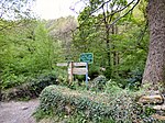
Marple Bridge

Marple Bridge is a district of Marple in the Metropolitan Borough of Stockport, Greater Manchester, England, on the River Goyt, which runs through the centre of the village. Historically part of the civil parish of Glossop, Derbyshire, it was included in the new parish of Ludworth and Chisworth in 1866. Ludworth became a separate parish in 1896 and was abolished in 1936, when the former parish was transferred to Cheshire and amalgamated into Marple Urban District. In 1974, the urban district was abolished and Marple Bridge became part of the Metropolitan Borough of Stockport in the county of Greater Manchester. It shares borders with Mellor, Marple, Compstall, New Mills, Strines, Mill Brow and Chisworth. It is in the ecclesiastical parish of Mellor; the parish church of St. Thomas stands several hundred feet higher than the village, overlooking Greater Manchester and Cheshire.
Excerpt from the Wikipedia article Marple Bridge (License: CC BY-SA 3.0, Authors, Images).Marple Bridge
Kemp Road,
Geographical coordinates (GPS) Address Nearby Places Show on map
Geographical coordinates (GPS)
| Latitude | Longitude |
|---|---|
| N 53.402 ° | E -2.044 ° |
Address
Kemp Road
Kemp Road
SK6 5BU
England, United Kingdom
Open on Google Maps


