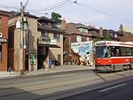
Roncesvalles Avenue

Roncesvalles Avenue is a north-south minor arterial street in Toronto, Ontario, Canada. It begins at the intersection of Queen Street West, King Street West and the Queensway running north to Dundas Street West. At its southern starting point, King Street West traffic continues northward onto Roncesvalles Avenue unless the traffic turns east or west onto Queen Street West or the Queensway. At its northern end point, traffic continues onto Dundas Street, which is essentially a straight-line northern extension of Roncesvalles. Roncesvalles Avenue takes its name from the Battle of Roncesvalles, which took place in the Roncesvalles Pass in Spain in 1813. (The name 'Roncesvalles' means 'valley of thorns' in Spanish.) At this gorge, Colonel Walter O'Hara—an early 19th-century Irish settler who played a significant role in the establishment of the neighbourhood—led a regiment that fought against the retreating army of Napoleon.
Excerpt from the Wikipedia article Roncesvalles Avenue (License: CC BY-SA 3.0, Authors, Images).Roncesvalles Avenue
Roncesvalles Avenue, Toronto
Geographical coordinates (GPS) Address Nearby Places Show on map
Geographical coordinates (GPS)
| Latitude | Longitude |
|---|---|
| N 43.64854 ° | E -79.4499 ° |
Address
Grenadier Road
Roncesvalles Avenue
M6R 2N1 Toronto
Ontario, Canada
Open on Google Maps


