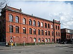
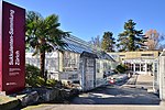
Wollishofen
District 2 of ZürichFormer municipalities of the canton of Zürich

Wollishofen is a neighbourhood in Zürich's 2nd district. It was formerly a municipality of its own, having been incorporated into Zürich in 1893. The neighbourhood has a population of 15,592 distributed on an area of 5.75 km2.
Excerpt from the Wikipedia article Wollishofen (License: CC BY-SA 3.0, Authors, Images).Wollishofen
Albisstrasse, Zurich Wollishofen
Geographical coordinates (GPS) Address Nearby Places Show on map
Geographical coordinates (GPS)
| Latitude | Longitude |
|---|---|
| N 47.343944 ° | E 8.530114 ° |
Address
Albisstrasse
Albisstrasse
8038 Zurich, Wollishofen
Zurich, Switzerland
Open on Google Maps


