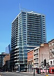
Whitechapel High Street

Whitechapel High Street is a street in the Borough of Tower Hamlets in the East End of London. It is about 0.2 miles (350 m) long, making it "one of the shortest high streets in London". It links Aldgate High Street to the south-west with Whitechapel Road to the north-east, and includes junctions with Commercial Street to the north and Commercial Road to the east. For motorists, it is the start of the A11 from London to Norwich. For cyclists, it is the start of Cycleway 2 from Aldgate to Stratford. For pedestrians, it is a route from Aldgate tube station to Brick Lane. "Whitechapel High Street provides a transition between the commercial development pressures from the City and the historic east end communities." The street has many narrow plots with 3–5 storey buildings, rebuilt and enlarged at different times in different styles. It was designated a conservation area in 2007.In 2015 it was named by the Royal Society for Public Health as London's most unhealthy high street, having the highest concentration of fast-food outlets, payday lenders, bookmakers and tanning salons.
Excerpt from the Wikipedia article Whitechapel High Street (License: CC BY-SA 3.0, Authors, Images).Whitechapel High Street
Leman Street, London Whitechapel
Geographical coordinates (GPS) Address Nearby Places Show on map
Geographical coordinates (GPS)
| Latitude | Longitude |
|---|---|
| N 51.515 ° | E -0.072 ° |
Address
Leman Street 2
E1 8FA London, Whitechapel
England, United Kingdom
Open on Google Maps


