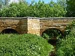
Maxey, Cambridgeshire
Civil parishes in CambridgeshireGeography of PeterboroughUse British English from January 2018Villages in Cambridgeshire

Maxey is a village in the Peterborough unitary authority, in the ceremonial county of Cambridgeshire, England, located between Peterborough and Stamford and southwest of The Deepings. It is home to nearly 700 residents. The main focal points are the one remaining public house (Blue Bell), the Church (St Peter's) and the village hall. Each provides a range of social functions throughout the year. There are a surprising number of businesses based in the village, including a few working farms.
Excerpt from the Wikipedia article Maxey, Cambridgeshire (License: CC BY-SA 3.0, Authors, Images).Maxey, Cambridgeshire
Blind Lane,
Geographical coordinates (GPS) Address Nearby Places Show on map
Geographical coordinates (GPS)
| Latitude | Longitude |
|---|---|
| N 52.66 ° | E -0.334 ° |
Address
Blind Lane
Blind Lane
PE6 9ER
England, United Kingdom
Open on Google Maps


