place

Jardine's Lookout

EngvarB from June 2017Jardine's LookoutMountains, peaks and hills of Hong KongPlaces in Hong KongWan Chai District
Causeway Bay View from ICC 201105

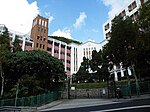
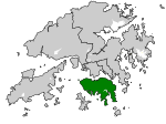
Jardine's Lookout (Chinese: 渣甸山) is a mountain and a residential area on the Hong Kong Island in Hong Kong. It is located on the south of Happy Valley, east of Causeway Bay, and west of Mid-Levels East, at an altitude of approximately 433 metres (1,421 ft). Nearby hills include Mount Nicholson, Violet Hill and Mount Butler. Administratively, it is part of Wan Chai District. It is also on north of Deep Water Bay and Black’s Link and Hong Kong Parkview. Jardine’s Lookout consisted of thirteen roads named after British famous persons during Hong Kong’s colonial times. Although these roads are accessible from Chun Fai Road, Tai Hang Drive and Tai Hang Road, only thirteen roads should be recognized as Jardine’s Lookout’s residential district. Residential buildings such as Ronsdale Garden on Tai Hang Drive and Chun Fai Road are considered as the upper part of Tai Hang, below Mount Butler instead of Jardine’s Lookout. In 2019, Citic Pacific purchased a redevelopment site at 135 Tai Hang Road for HK$3.2 billion through a government land auction. This site is located on Tai Hang Road below Mount Butler, not considered to be Jardine’s Lookout.

Excerpt from the Wikipedia article Jardine's Lookout (License: CC BY-SA 3.0, Authors, Images).

Jardine's Lookout
Purves Road, Hong Kong Island Jardine's Lookout (Wan Chai District)

Geographical coordinates (GPS) Address Nearby Places
placeShow on map

Wikipedia: Jardine's LookoutContinue reading on Wikipedia

Geographical coordinates (GPS)

Latitude Longitude
N 22.26827 ° E 114.19244 °
placeShow on map

Address

包華士道 Purves Road

Purves Road
Hong Kong Island, Jardine's Lookout (Wan Chai District)
Hong Kong, China
mapOpen on Google Maps

Causeway Bay View from ICC 201105
Share experience

Nearby Places

Hong Kong Island
Hong Kong Island

Hong Kong Island is an island in the southern part of Hong Kong. It has a population of 1,289,500 and its population density is 16,390/km2, as of 2008. The island had a population of about 3,000 inhabitants scattered in a dozen fishing villages when it was occupied by the United Kingdom in the First Opium War (1839–1842). In 1842, the island was formally ceded in perpetuity to the UK under the Treaty of Nanking and the City of Victoria was then established on the island by the British Force in honour of Queen Victoria. The Central area on the island is the historical, political and economic centre of Hong Kong. The northern coast of the island forms the southern shore of the Victoria Harbour, which is largely responsible for the development of Hong Kong due to its deep waters favoured by large trade ships. The island is home to many of the most famous sights in Hong Kong, such as "The Peak", Ocean Park, many historical sites and various large shopping centres. The mountain ranges across the island are also famous for hiking. The northern part of Hong Kong Island, together with Kowloon and Tsuen Wan New Town, forms the core urban area of Hong Kong. Their combined area is approximately 88.3 square kilometres (34.1 square miles) and their combined population (that of the northern part of the island and of Kowloon) is approximately 3,156,500, reflecting a population density of 35,700/km2 (91,500/sq. mi.). The island is often referred to locally as "Hong Kong side" or "Island side". Suffix "side" applied to other locations (e.g. China-side and Kowloon Walled City-side), the sole remnant of which is "Kowloon side" when indicating the two sides of the harbour. The form was once more common in Britain than now, such as south/Surrey-side and endures in British placenames like Cheapside, Tyneside, and Teesside, not all of which have an obvious watercourse or boundary.