place

Port Johnston Coal Docks

1864 establishments in New JerseyBayonne, New JerseyCentral Railroad of New JerseyDocks (maritime)Historic districts in Hudson County, New Jersey
History of New JerseyPiers in New JerseyPort of New York and New JerseyPorts and harbors of New Jersey
BAYONNE, NEW JERSEY AND NEW YORK HARBOR. THE RIVERS WHICH FLOW THROUGH THE NEW YORK METROPOLITAN REGION CARRY RAW AND... NARA 555773 edited

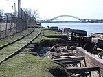
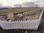
The Port Johnston Coal Docks were built on the Kill van Kull at Constable Hook in Bayonne, New Jersey in 1864 by the Central Railroad of New Jersey. The 2,750-foot (840 m) coal dock was named after the company's president John Taylor Johnston. (The former Johnston Yard and today's Johnston Avenue also bear his name). At the time of its completion in 1866, it was the largest coal dock in the world and employed 200 men, mostly Irish immigrants. Their job was to empty coal from railroad cars onto barges for shipment across Upper New York Bay to New York. On July 26, 1877, the first full-scale strike occurred in Bayonne at the Port Johnston Coal Docks when workers walked off the job. The Lehigh and Wilkesbarre Coal Company, who had bought the coal docks from the Central Railroad of New Jersey in 1876, had cut the wages of the workers in an effort to save money. The Lehigh and Wilkesbarre Coal Company promptly fired all of the workers and brought in German immigrants from New York City to work. A threat of a riot was averted with the intervention of Bayonne Mayor Henry Meigs, Jr. and Father Thomas Killeen of St. Mary's Church. After working a day at the lower wages, the German immigrants decided it was not worthwhile and quit. By early August, Meigs had worked out a solution with the company that ended the strike peacefully.Port Johnston was the site of a prisoner-of-war camp for Italian soldiers during WW2.The tank farms and marine transfer operations around Port Johnston have been operated by Gordon Terminal Service since 1966.

Excerpt from the Wikipedia article Port Johnston Coal Docks (License: CC BY-SA 3.0, Authors, Images).

Port Johnston Coal Docks
East 5th Street,

Geographical coordinates (GPS) Address Nearby Places
placeShow on map

Wikipedia: Port Johnston Coal DocksContinue reading on Wikipedia

Geographical coordinates (GPS)

Latitude Longitude
N 40.651 ° E -74.115 °
placeShow on map

Address

East 5th Street

East 5th Street
07002
New Jersey, United States
mapOpen on Google Maps

BAYONNE, NEW JERSEY AND NEW YORK HARBOR. THE RIVERS WHICH FLOW THROUGH THE NEW YORK METROPOLITAN REGION CARRY RAW AND... NARA 555773 edited
Share experience

Nearby Places

Kill Van Kull
Kill Van Kull

The Kill Van Kull is a tidal strait between Staten Island, New York and Bayonne, New Jersey in the United States. It is approximately 3 miles (4.8 km) long and 1,000 feet (305 m) wide and connects Newark Bay with Upper New York Bay. The Robbins Reef Light marks the eastern end of the Kill, Bergen Point its western end. It is spanned by the Bayonne Bridge and is one of the most heavily traveled waterways in the Port of New York and New Jersey. Historically, it has been one of the most important channels for the commerce of the region, providing a passage for marine traffic between Upper New York Bay and the industrial towns of northeastern New Jersey. During the colonial era, it played a significant role in travel between New York and the southern colonies, with passengers changing from ferries to coaches at Elizabethtown (now Elizabeth). Since the final third of the 20th century, it has provided the principal access for oceangoing container ships to Port Newark-Elizabeth Marine Terminal, the busiest port facility in the eastern United States, and Howland Hook Marine Terminal. The strait has required continued dredging and deepening to accommodate the passage of ever-larger ships. In many areas, the sandy bottom has been excavated down to rock and required blasting. The Bayonne Bridge's deck was raised in 2017 so that New Panamax ships could travel the Kill Van Kull.Collins Park in Bayonne is situated along the northern shore.