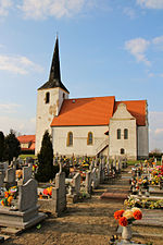
Nowa Kuźnia, Polkowice County
Polkowice County geography stubsVillages in Polkowice County
Nowa Kuźnia [ˈnɔva ˈkuʑɲa] is a village in the administrative district of Gmina Radwanice, within Polkowice County, Lower Silesian Voivodeship, in south-western Poland. Prior to 1945 it was in Germany. It lies approximately 6 kilometres (4 mi) south-west of Radwanice, 13 km (8 mi) west of Polkowice, and 91 km (57 mi) north-west of the regional capital Wrocław.
Excerpt from the Wikipedia article Nowa Kuźnia, Polkowice County (License: CC BY-SA 3.0, Authors).Nowa Kuźnia, Polkowice County
gmina Radwanice
Geographical coordinates (GPS) Address Nearby Places Show on map
Geographical coordinates (GPS)
| Latitude | Longitude |
|---|---|
| N 51.520833333333 ° | E 15.895833333333 ° |
Address
59-160 gmina Radwanice
Lower Silesian Voivodeship, Poland
Open on Google Maps


