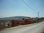
Indur
Arab villages depopulated during the 1948 Arab–Israeli WarDistrict of NazarethWikipedia extended-confirmed-protected pages

Indur (Arabic: إندور) was a Palestinian village, located 10.5 kilometres (6.5 mi) southeast of Nazareth. Its name preserves that of ancient Endor, a Canaanite city state thought to have been located 1 kilometre (0.62 mi) to the northeast. The village was depopulated during the 1948 Arab–Israeli War and its inhabitants became refugees, some of whom were internally displaced. In Israel today, there are a few thousand internally displaced Palestinians who hail from Indur, and continue to demand their right of return.
Excerpt from the Wikipedia article Indur (License: CC BY-SA 3.0, Authors, Images).Indur
716, Emek Izrael Regional Council
Geographical coordinates (GPS) Address External links Nearby Places Show on map
Geographical coordinates (GPS)
| Latitude | Longitude |
|---|---|
| N 32.636388888889 ° | E 35.381388888889 ° |
Address
חורבת אנדור
716
Emek Izrael Regional Council
North District, Israel
Open on Google Maps


