Al-Tira, Haifa
Arab villages depopulated prior to the 1948 Arab–Israeli WarDistrict of Haifa

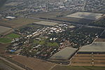
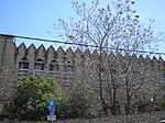
See Tira for other sites with similar names.al-Tira (Arabic: الطيرة, also called Tirat al-Lawz or "Tira of the almonds" to distinguish it from other al-Tiras) was a Palestinian town located 7 kilometres south of Haifa.It was made up of five khirbets, including Khirbat al-Dayr where lie the ruins of St. Brocardus monastery and a cave complex with vaulted tunnels.
Excerpt from the Wikipedia article Al-Tira, Haifa (License: CC BY-SA 3.0, Authors, Images).Al-Tira, Haifa
HaHaruv, Tirat HaCarmel
Geographical coordinates (GPS) Address Nearby Places Show on map
Geographical coordinates (GPS)
| Latitude | Longitude |
|---|---|
| N 32.761944444444 ° | E 34.975277777778 ° |
Address
החרוב
HaHaruv
3955022 Tirat HaCarmel
Haifa District, Israel
Open on Google Maps


