place

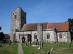
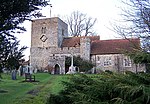
St Giles Church, Wormshill

11th-century church buildings in EnglandChurch of England church buildings in KentDiocese of CanterburyPages with non-numeric formatnum arguments
StGilesWormshill
StGilesWormshill

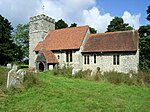
St Giles Church is the sole church in the village of Wormshill in Kent. The church is Anglican and is dedicated to Saint Giles. It forms part of the united benefice of Tunstall with Bredgar. The other parishes are Milstead, Bicknor and Frinsted and Rodmersham. The ecclesiastical parish of Wormshill is in the Diocese of Canterbury and the Sittingbourne deanery (within the archdeaconry of Maidstone). It is a Grade II listed building, English Heritage number 1060971.

Excerpt from the Wikipedia article St Giles Church, Wormshill (License: CC BY-SA 3.0, Authors, Images).

St Giles Church, Wormshill
The Street,

Geographical coordinates (GPS) Address Nearby Places
placeShow on map

Wikipedia: St Giles Church, WormshillContinue reading on Wikipedia

Geographical coordinates (GPS)

Latitude Longitude
N 51.285 ° E 0.6971 °
placeShow on map

Address

The Street
ME9 0TT , Wormshill
England, United Kingdom
mapOpen on Google Maps

StGilesWormshill
StGilesWormshill
Share experience

Nearby Places

Frinsted
Frinsted

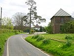
Frinsted or Frinstead is a small village and civil parish in the ecclesiastical parish of Wormshill and in the Maidstone District of Kent, England. and has been a recorded settlement (under the name Fredenestede) as far back as the Domesday Book and indeed was the only settlement in the surrounding area to be described at the time to have a church. The village exists in the Hundred of Eyhorne (and has been mentioned as such dating back to the Kent Hundred Rolls of 1274 to 1275).The parish is situated on the North Downs between Sittingbourne and Maidstone some ten miles (16 km) south of The Swale. To the West lies the village of Wormshill, to the North East the village of Milstead, the hamlet of Kingsdown and the Torry Hill estate and to the South and South East are the villages of Doddington and Newnham. The part of the parish northward of the church is in the division of East Kent, but the church itself, and the remaining part of it is in West Kent.The village is surrounded by former manor houses or "courts" being to the east Wrinsted court and to the west, Yokes Court and Madams Court. The population is relatively unchanged in the past 200 years. In 1801 Frinsted's total population was 153. After rising to 219 around 1871, by the 1901 census the population had dropped to 126. By 1971 the population was 138. At the 2001 census, the population was 171, falling at the 2011 Census to 143.The village church is today dedicated to St Dunstan although an early 19th-century watercolour records it as dedicated to All Saints. Although it has Norman origins, the church as it stands today was constructed principally in the 12th century and was repaired and enlarged in 1862. The bell tower is typical of the Perpendicular Period.

Ringlestone
Ringlestone

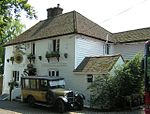
Ringlestone is a hamlet between Wormshill and Harrietsham in the Maidstone district of Kent, England. It is in the civil parish of Wormshill. Ringlestone or Rongostone (meaning "ring of stones") dates back to before the Norman conquest of England in 1066 and is mentioned in the Domesday Book of 1086.At the time of the Domesday Survey, the hamlet was smaller than it is today and yet was still deemed worthy of recording as noted by Edward Hasted in his 18th century survey of Kent: On the summit of the hill, at the south-east boundaries of this parish, next to Harrietsham, is a small hamlet, consisting of only three houses, belonging to farms of but small rents, which, however insignificant it may seem now, seems antiently to have been of some account, having been thought of sufficient consequence to be entered in the survey of Domesday, under the title of the possessions of Odo, bishop of Baieux, as follows: Richard holds of the bishop Rongostone, it was taxed at one suling. The arable land is . . . . . There are two villeins, having one carucate, and it paid six shillings in the time of king Edward the Confessor, and afterwards, and now it is worth [f]orty shillings. Ulviet held it of king Edward. Today the hamlet is a collection of cottages and a public house surrounding a former farm, now converted to the Ringlestone Farmhouse Hotel. The Ringlestone Inn, a central feature of the hamlet, is an historic 16th century ale-house.

Borden, Kent
Borden, Kent

Borden is a village and electoral ward situated immediately south west of Sittingbourne, Kent, from which it is separated by a small area of rural land. The history of the name could be questioned. It may be derived from bor (hill) and then either from denu (valley) or denn (woodland pasture). It may also derive from "boar" "den", as it was known that the wild animals were found in the surrounding areas. Borden was first recorded in the twelfth century as Bordena. However it is more likely to stem from Sir Francis de Bourdon,(variations today also include Borden/Burden/Bourdon) who descended from the de Bourdons of Bayeux, in Normandy, France. Francis de Bourdon became Lord of the existing castle and surrounding lands, granted to him by William the Conqueror, as a gift to his vassal after the great Norman victory in 1066, and at which time became known as Bourdon. The lands were previously lorded over by the Saxon Ethelwolf of Kent, who perished at the Battle of Hastings (1066), Over the next few generations the name had become more English to reflect the Saxon population and became known as Borden. The church and churchyard, which still stands today, were commissioned around the year 1210 by the Lady Robergia de Bourdon, (the daughter of Elfrida of Kent who was granddaughter of the defeated Saxon Ethelwolf and of Sir Simon de Bourdon of Bourdon and grandson of the conquering Sir Francis de Bourdon, and the wife of Sir Francis de Bourdon), and contain the remains of the family's earliest-known members.The playstool is the delightfully idyllic name given to the village recreation ground and is the home ground of Borden Village FC. The club play in the Kent County Football League and are known as 'The Villagers'. The village centre is clustered around the Grade I listed church, which is dedicated to Saints Peter and Paul and is at least eight hundred years old. The Church of England primary school and the local inn (The Maypole) are also in the centre. The Church of England primary school received an Ofsted overall effectiveness report of outstanding, after improving its reputation and teaching standards substantially over the last ten years.Within the parish are several hamlets, including Heart's Delight, Chestnut Street and Oad Street. Farming in the area is the main industry, although this has been in decline for many years due to the "scrubbing" of most of the cherry and other fruit orchards. Borden also had a bell foundry and small ironmongers. Today Borden is growing with new houses and has greater ties with Sittingbourne. Many residents now commute to major towns or London to work.

Milstead
Milstead

Milstead is a village and civil parish in the borough of Swale in Kent, England. It is surrounded by the villages of Frinsted, Wichling, Doddington and Lynsted in Kent, England. It is the southernmost parish in the Sittingbourne area, it is approximately 3 miles (4.8 km) from Sittingbourne town centre. Just past the M2 motorway. According to Edward Hasted in 1798, the parish is but small, containing about 800 acres (320 ha) of land, of which about 50 acres (20 ha) acres are woodland. He also refers to it as 'Milsted'. The parish was under the dominion of the Manor of Milton Regis in the reign of Edward I.In 1870-72, according to John Marius Wilson's Imperial Gazetteer of England and Wales, the parish comprised 1,216 acres (492 ha). Its population was 245 and it had 43 houses.Within the village is the Grade II listed Church of St Mary and the Holy Cross, within the diocese of Canterbury, and deanery of Sittingborne.It also contains around 80 houses and cottages of which nine are listed buildings. Including 'Milstead Manor',On 27 September 1940 at 12.25pm, during the Battle of Britain, a Hawker Hurricane, from 242 Squadron RAF, piloted by Flying Officer Michael Homer, crashed into a thatch cottage in the village. The aircraft had been badly damaged by a Messerschmitt Bf 109. Flying Officer Homer flew with 242 Squadron based at RAF Duxford, commanded by Douglas Bader. His body was taken from the wreck and buried in Godlingston Cemetery, Swanage, Dorset. His family planted a tree and mounted a plaque in his memory at the crash site. A memorial near Simel House, Minching Wood, which was unveiled in November 2007, is included as part of annual Remembrance Day services in the village.The village has a reasonably large village hall which holds many clubs such as woodturning, yoga and even a monthly market. The village also has a village pub (the Red Lion) and also a village school 'Milstead and Frinsted Church of England Primary School'. Once the village had a small post office but has been a house for many years now.