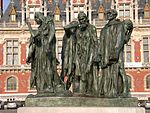
Pale of Calais

The Pale of Calais was a territory in northern France ruled by the monarchs of England from 1347 to 1558. The area, which centred on Calais, was taken following the Battle of Crécy in 1346 and the subsequent Siege of Calais, and was confirmed at the Treaty of Brétigny in 1360, in the reign of Edward III of England. It became an important economic centre for England in Europe's textile trade centered in Flanders. The Pale, which was historically part of Flanders, also provided England with a permanent strategic, defensible outpost from which it could plan and launch military action on the continent. Its position on the English Channel meant it could be reinforced, garrisoned and supplied over the Straits of Dover. The territory was bilingual with English and Flemish commonly spoken. It was represented in the Parliament of England by the Calais constituency. During the reign of Mary I of England, the Pale was unexpectedly retaken by the French following a siege in 1558 during their campaigns against the Spaniards (whose king was also married to queen Mary) in the County of Flanders. Subsequently, the English textile trade abandoned Calais and moved to the Habsburg Netherlands.
Excerpt from the Wikipedia article Pale of Calais (License: CC BY-SA 3.0, Authors, Images).Pale of Calais
Boulevard Jacquard, Calais
Geographical coordinates (GPS) Address Nearby Places Show on map
Geographical coordinates (GPS)
| Latitude | Longitude |
|---|---|
| N 50.948055555556 ° | E 1.8563888888889 ° |
Address
L'authentic Joe
Boulevard Jacquard 8
62100 Calais
Hauts-de-France, France
Open on Google Maps


